Manual interpretation workflow
May 21, 2023· 2 minutes reading
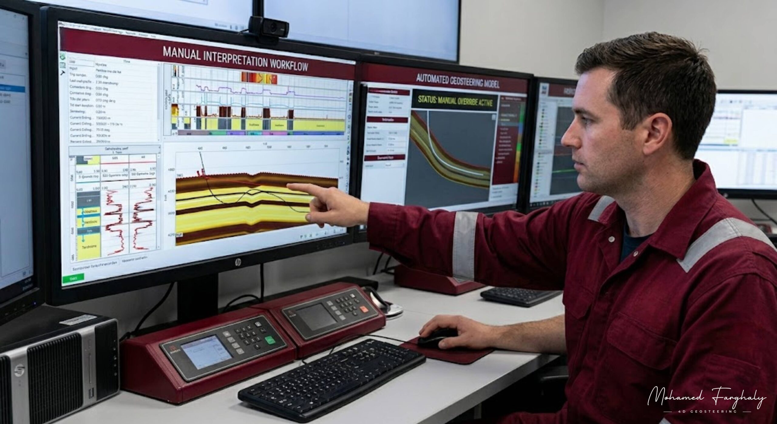
In today’s oil and gas industry, geosteering automation systems can process real-time data in seconds, but the subsurface still refuses to behave in a fully predictable way. That is exactly why the manual interpretation workflow in geosteering remains a core part of successful well placement decisions, especially in complex and thin reservoirs where small geological changes can completely change drilling outcomes.
The manual interpretation workflow starts with continuous tracking of real-time LWD (Logging While Drilling) data such as gamma ray, resistivity, density, neutron porosity, and wellbore inclination. These measurements are streamed into interpretation systems and compared against the pre-drill geological model. While automation provides quick model updates, interpreters manually evaluate whether the response truly reflects the formation or if it is influenced by drilling conditions, tool behavior, or structural uncertainty.
A key part of the workflow is data quality control and filtering. Not every signal coming from downhole tools is directly interpretable. Engineers must distinguish between true formation changes and noise caused by borehole effects, tool standoff, or drilling dynamics. This step is critical because incorrect interpretation at this stage can lead to poor steering decisions.
After that comes real-time correlation and geological matching, where interpreters align observed responses with expected stratigraphic markers. They manually identify bed boundaries, faults, formation dips, and thickness variations, often adjusting the geological model to better fit reality. In many cases, the manual update is what prevents the well from exiting the target zone.
Another important stage is model updating and calibration. When mismatches appear between measured data and predicted trends, interpreters adjust parameters such as structural dip, layer thickness, and reservoir position. This keeps the geosteering model continuously aligned with actual subsurface conditions rather than relying on static assumptions.
The workflow also includes decision-making under uncertainty, where automation may suggest steering actions, but human experts evaluate geological plausibility, operational risks, and drilling constraints before approving any change in trajectory. This human layer ensures that decisions are not only fast but also geologically reliable.
Finally, manual interpretation directly supports real-time communication with the drilling team, translating geological understanding into actionable steering instructions that control directional drilling tools and keep the well within the reservoir sweet spot.
🔗 Keywords
Well Correlation, Offset Wells, Formation Tops, Gamma Ray Correlation, Resistivity Trends, LWD Data, Structural Dip, Fault Detection, Stratigraphic Variation, Reservoir Modeling, 3D Geosteering Models, Well Placement Optimization, Geological Uncertainty.
