Correlation between wells
May 18, 2023· 2 minutes reading
What if the key to successfully steering your current well is not actually inside the well you are drilling—but hidden in the data of wells drilled kilometers away?
In geosteering, this is not just a possibility, it is a daily reality. Every drilling decision is built on the ability to understand how the subsurface geology changes laterally and vertically across a field. While real-time LWD (Logging While Drilling) data provides immediate feedback from the current well, it is the integration with offset well correlation that gives meaning to those signals.
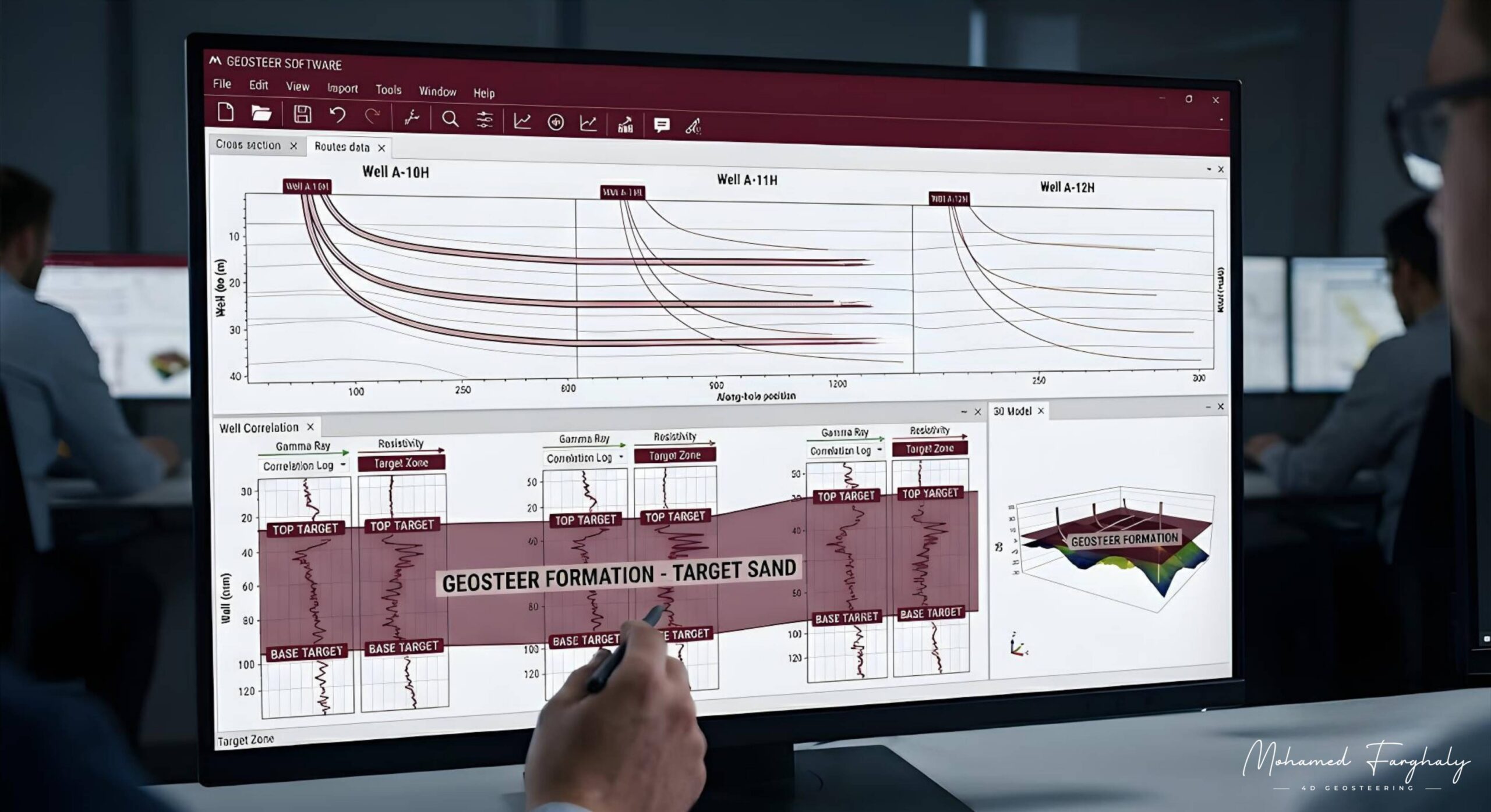
Well correlation is the process of linking geological information between multiple wells to build a consistent and reliable subsurface model. It starts by identifying shared geological markers such as formation tops, gamma-ray peaks, resistivity trends, and distinctive lithological boundaries. When these features are matched across different wells, they reveal how the reservoir behaves across space—whether it is stable, thinning, thickening, or structurally displaced.
Before drilling even begins, correlation plays a critical role in building the initial geosteering model. Data from surrounding wells is used to define the expected reservoir depth, structural dip, and possible fault zones. This allows geoscientists to design a well trajectory that stays within the most productive part of the reservoir, while also accounting for geological uncertainty.
During drilling, the importance of correlation becomes even more evident. As LWD measurements come in, they are constantly compared to the predicted responses derived from offset wells. When the real-time data matches the correlated model, confidence in the geological interpretation increases. However, when differences appear, geosteering teams must quickly evaluate whether they are seeing a structural shift, a stratigraphic variation, a fault intersection, or a change in reservoir quality.
In more complex reservoirs, a single well can be misleading. Correlation across multiple wells often reveals subtle regional trends, such as gradual reservoir thinning in one direction or consistent structural stepping between fault blocks. These patterns are invisible without integrating multiple data points, yet they directly influence well placement decisions and steering strategy.
Modern 3D geosteering models rely heavily on continuous updates from new wells. Each drilled well improves the correlation framework, refining the understanding of the reservoir and reducing uncertainty for future operations. Over time, the field evolves from isolated well interpretations into a connected and dynamic geological model.
In this way, well correlation is not just a support tool—it is the foundation that connects real-time drilling decisions to the broader geological picture, ensuring that every meter drilled is guided by a deeper understanding of the reservoir system.
🔗 Keywords
Well Correlation, Offset Wells, Formation Tops, Gamma Ray Correlation, Resistivity Trends, LWD Data, Structural Dip, Fault Detection, Stratigraphic Variation, Reservoir Modeling, 3D Geosteering Models, Well Placement Optimization, Geological Uncertainty.
