Depth considerations in Artificial Lift Systems
July 3, 2023· 2 minutes reading
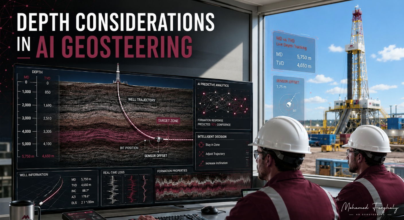
Artificial intelligence can process large volumes of drilling and geological data quickly. However, AI in geosteering depends heavily on accurate depth information. A strong prediction at the wrong depth can lead to an incorrect geological interpretation and, ultimately, a poor steering decision.
Therefore, depth is not simply another input variable. It provides the spatial framework that connects LWD measurements, well trajectory, formation boundaries, and the position of the bit.
Why Depth Accuracy Matters for AI Geosteering
During drilling, AI models may combine gamma ray, resistivity, drilling parameters, trajectory data, offset wells, and geological models. Each measurement must correspond to the correct position along the wellbore.
For example, the system may work with Measured Depth (MD) to identify where a measurement occurs along the borehole. Meanwhile, True Vertical Depth (TVD) helps relate the well trajectory to the vertical position of geological layers.
If depth references become inconsistent, the AI model may associate a geological response with the wrong formation position. Consequently, even a technically accurate machine-learning model can generate misleading interpretations.
Research in AI-assisted geosteering increasingly focuses on estimating the position of the well relative to stratigraphic layers and updating those estimates as new measurements arrive.
Sensor Offset and Depth Matching
Another important depth consideration is sensor-to-bit offset.
LWD sensors normally acquire information from positions behind—or, for some deep-reading technologies, around and ahead of—the bit. Therefore, the measurement depth and current bit depth do not always represent the same geological location.
An AI workflow must correctly account for these offsets before combining multiple data streams. Otherwise, the model could interpret an earlier formation response as if it represented the geology currently being drilled.
Accurate depth matching and synchronization become particularly important when AI continuously updates the geological model in real time.
Depth Uncertainty and Geological Boundaries
Depth itself also contains uncertainty. Survey uncertainty, formation dip, structural complexity, interpretation uncertainty, and tool response can affect the estimated relationship between the well and nearby bed boundaries.
Instead of treating every boundary depth as exact, advanced AI-assisted workflows can represent several possible geological interpretations and update their probabilities as new LWD measurements arrive. Ensemble-based geosteering research, for example, estimates both formation properties and boundary locations together with their uncertainty.
This approach helps AI distinguish between what is known, what is estimated, and what remains uncertain.
Look-Ahead Depth in AI-Assisted Geosteering
Depth considerations become even more important when AI attempts to predict geology ahead of the bit.
Machine-learning methods can use available drilling and petrophysical information to estimate lithology or geological conditions at undrilled depths. Recent research has demonstrated AI-driven workflows that progressively update subsurface uncertainty around and ahead of the bit as real-time measurements become available.
However, prediction confidence should generally change with the available evidence. A nearby prediction supported by strong measurements may carry different uncertainty from a prediction farther ahead.
For geosteering, the key question is therefore not only “What does the AI predict?” but also:
“At what depth does it predict it, how accurately is that depth known, and how far is that prediction from the bit?”
These depth considerations allow AI to support more reliable formation interpretation, boundary detection, trajectory evaluation, and real-time geosteering decisions.
🔗 Keywords
Drilling Rig, Drilling Mud, MWD, LWD, Directional Drilling, Geosteering, Well Placement, Oil Reservoir, Surface Logging, Borehole Imaging, Electromagnetic Resistivity LWD Tool, Bottom Hole Assembly, Study of Real-Time LWD Data, LWD Interpretation, Borehole Image Log, Dip Calculation Methods, Shale Gas Sweet Spot, Accurate Reservoir Boundary Detection, Machine Learning, Artificial Intelligence, The Future of Automated Geosteering, Ensemble-Based Well Log Interpretation, Digital Twins in Drilling, Remote Operations Centers