Measurement While Drilling (MWD)
April 28, 2023· 2 minutes reading
What is Measurement While Drilling?
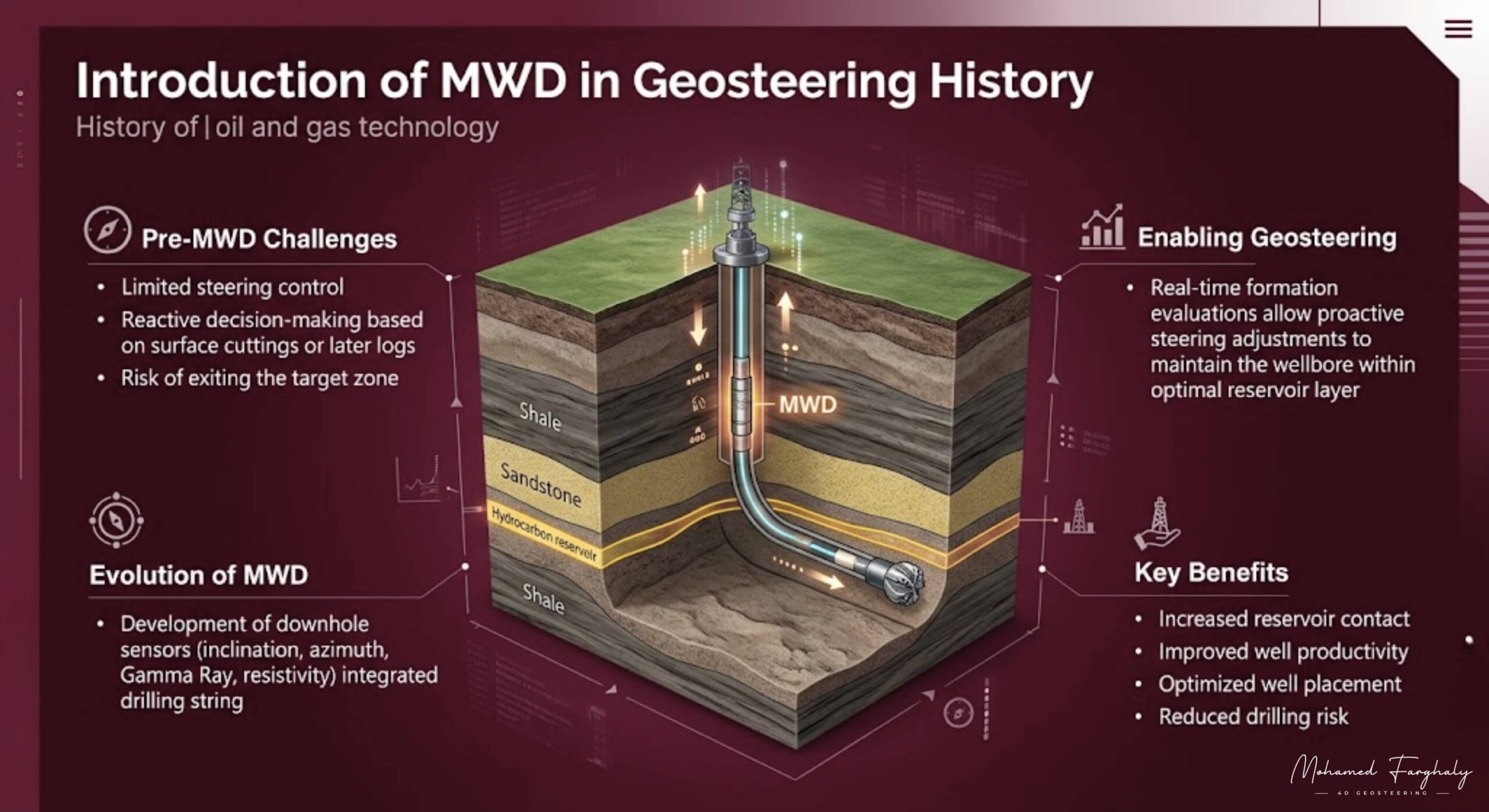
Deep beneath the surface, where direct observation is impossible, every drilling decision depends on reliable data. Measurement While Drilling (MWD) is the foundational technology that makes modern directional drilling possible. By providing real-time information about the well’s position and downhole environment, MWD turns underground uncertainty into safe, informed action during live operations.
How the MWD System Tracks Trajectory
At its core, an MWD system is designed to track the precise three-dimensional trajectory of the wellbore. By measuring key directional parameters, it ensures the wellbore stays on its planned geological path.
These critical directional measurements include:
- Inclination: The deviation angle of the wellbore from vertical.
- Azimuth: The compass direction of the wellbore path.
- Toolface orientation: The orientation of the drilling bit face relative to the formation.
Acquiring these continuous measurements is vital for achieving accurate well placement. This is especially true in complex reservoirs, where even a minor mathematical deviation can cause the bit to miss the target zone entirely.
Real-Time Data and Mud Pulse Telemetry
To collect this data, engineers integrate the MWD tool directly into the Bottom Hole Assembly (BHA), positioned close to the drill bit. Internal electronic sensors continuously record downhole conditions. The system then transmits these data points up to the surface using mud pulse telemetry.
During this transmission process, a downhole modulator creates acoustic pressure waves within the circulating drilling mud. Surface transducers then capture these signals and translate them into readable engineering data. This continuous data stream allows operators to monitor drilling performance instantly and make immediate steering adjustments, rather than waiting until pulling the drill string out of the hole.
Combining MWD and LWD for Geosteering
While MWD focuses primarily on wellbore positioning and drilling dynamics, it works hand-in-hand with Logging While Drilling (LWD). While MWD maps the path, LWD sensors measure formation properties like gamma ray and resistivity to evaluate the rock matrix.
Together, these two technologies form the absolute backbone of modern geosteering operations. By combining the precise trajectory tracking of MWD with the geological formation insights of LWD, cross-functional asset teams can successfully navigate and keep the wellbore within the most productive zones of the oil reservoir.
Optimizing Efficiency and Safety
Beyond directional navigation, an MWD tool measures critical structural and environmental parameters to protect downhole assets. These safety measurements include real-time downhole temperature, mechanical vibration, shock, and weight on bit (WOB).
Monitoring these mechanical dynamics helps engineering teams optimize overall drilling efficiency, mitigate tool wear, and prevent catastrophic drill string failures. When operators integrate this downhole intelligence with traditional surface logging, they gain a comprehensive, dual-perspective view of the entire drilling operation.
🔗 Keywords
Drilling Rig, Drilling Mud, MWD, LWD, Directional Drilling, Geosteering, Well Placement, Oil Reservoir, Surface Logging, Borehole Imaging, Electromagnetic Resistivity LWD Tool, Bottom Hole Assembly, Study of Real-Time LWD Data, LWD Interpretation, Borehole Image Log, Dip Calculation Methods, Shale Gas Sweet Spot, Accurate Reservoir Boundary Detection, Machine Learning, Artificial Intelligence, The Future of Automated Geosteering, Ensemble-Based Well Log Interpretation, Digital Twins in Drilling, Remote Operations Centers