Remote Operations Centers
Jan 10, 2026 · 2 minutes reading
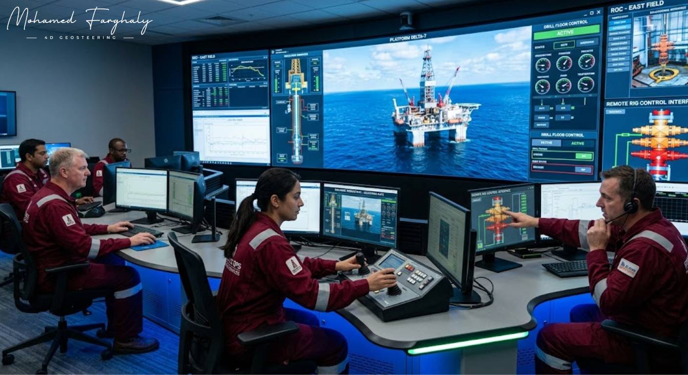
What if geosteering decisions could be made by a full team of experts without being physically on the rig site? That is exactly what Remote Operations Centers bring to modern geosteering operations — a connected environment where real-time data meets collective expertise.
In today’s drilling industry, Remote Operations Centers (ROCs) allow engineers, geologists, and geosteerers to monitor and control operations from a centralized location. For geosteering, this means continuous access to real-time LWD data, MWD measurements, and surface information, all analyzed by specialists working together.
The strength of remote geosteering lies in collaboration and speed. Instead of relying on a limited on-site team, multiple experts can interpret data simultaneously, improving geosteering decisions and increasing overall geosteering accuracy. This leads to better well placement and more efficient drilling operations.
In directional drilling, where geosteering requires constant monitoring and adjustment, Remote Operations Centers provide a major advantage. They enable faster response to formation changes, better communication between teams, and more consistent geosteering operations across multiple wells.
When combined with advanced technologies such as artificial intelligence, machine learning, and digital twins, Remote Operations Centers become even more powerful for geosteering. These technologies enhance data interpretation, support predictive analysis, and improve real-time geosteering decisions.
Another key benefit of remote geosteering operations is risk reduction. By centralizing expertise and improving data access, companies can reduce operational errors, enhance safety, and maintain better control over drilling performance.
Many still think of geosteering as a rig-based activity, but Remote Operations Centers are changing that perspective. They allow geosteering to become more scalable, more collaborative, and more data-driven.
If you want to understand how modern geosteering is evolving, start with Remote Operations Centers. They are redefining how data, expertise, and technology come together to deliver smarter geosteering decisions.
🔗 Keywords
Drilling Rig, Drilling Mud, MWD, LWD, Directional Drilling, Geosteering, Well Placement, Oil Reservoir, Surface Logging, Borehole Imaging, Electromagnetic Resistivity LWD Tool, Bottom Hole Assembly, Study of Real-Time LWD Data, LWD Interpretation, Borehole Image Log, Dip Calculation Methods, Shale Gas Sweet Spot, Accurate Reservoir Boundary Detection, Machine Learning, Artificial Intelligence, The Future of Automated Geosteering, Ensemble-Based Well Log Interpretation, Digital Twins in Drilling, Remote Operations Centers
