Surface Logging
Sept 2, 2023· 3 minutes reading
Surface logging in geosteering provides continuous information about subsurface conditions during drilling. Although downhole tools supply essential measurements, surface data adds valuable geological and operational context. As a result, drilling teams can make faster decisions, reduce uncertainty, and improve well placement.
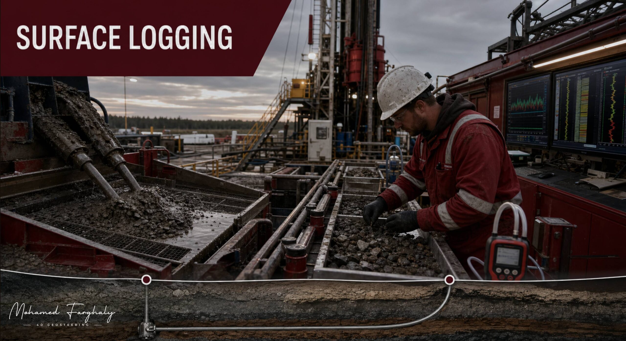
Mud loggers perform this process by monitoring drilling returns at the surface. They analyze rock cuttings, gas readings, drilling mud, and operational parameters. Together, these data sources help the team identify formation changes, potential reservoir zones, and drilling hazards.
How Surface Logging Supports Geosteering
As the drill bit moves through different formations, drilling mud carries rock fragments to the surface. Mud loggers examine these cuttings to determine lithology, mineral composition, grain size, and hydrocarbon shows. Therefore, changes in the cuttings may reveal that the well has entered a new geological layer.
Gas monitoring also provides important information. For example, changes in total gas or gas composition may indicate hydrocarbons, pressure variations, or reservoir entry. Even small changes can influence the geosteering strategy and help the team avoid costly mistakes.
In addition, surface systems continuously track drilling parameters such as:
- Rate of penetration
- Weight on bit
- Rotary speed
- Torque
- Standpipe pressure
- Mud flow rate
- Mud properties
These measurements help specialists understand how the formation affects drilling performance. A sudden increase in the rate of penetration, for instance, may suggest a softer rock layer. However, the team must compare this change with cuttings, gas readings, and downhole measurements before adjusting the well path.
Surface logging in geosteering is especially valuable because it supports real-time decision-making. It can provide early warnings of formation changes, pressure shifts, fluid variations, and drilling hazards. Consequently, engineers can respond before these conditions affect safety or well placement.
Combining Surface and Downhole Data
MWD and LWD tools collect measurements close to the drill bit. These tools provide information about direction, gamma ray, resistivity, density, porosity, and other formation properties. Surface logging works differently because it examines material and signals that return to the rig.
Despite this difference, both data sources support the same objective. When teams combine them, they create a clearer picture of the subsurface. For example, gas readings and cuttings descriptions can confirm an interpretation based on real-time LWD data. Likewise, downhole measurements can help explain unexpected changes observed at the surface.
This integration also improves LWD interpretation. Instead of relying on one measurement, geosteering specialists can compare several independent indicators. Therefore, they can identify reservoir boundaries with greater confidence and make more reliable steering recommendations.
Surface data does have a time delay because drilling returns need time to travel from the bit to the rig. The team must calculate this lag carefully to match surface observations with the correct drilling depth. Accurate lag calculation is essential for reliable geological correlation.
🔗 Keywords
Drilling Rig, Drilling Mud, MWD, LWD, Directional Drilling, Geosteering, Well Placement, Oil Reservoir, Surface Logging, Borehole Imaging, Electromagnetic Resistivity LWD Tool, Bottom Hole Assembly, Study of Real-Time LWD Data, LWD Interpretation, Borehole Image Log, Dip Calculation Methods, Shale Gas Sweet Spot, Accurate Reservoir Boundary Detection, Machine Learning, Artificial Intelligence, The Future of Automated Geosteering, Ensemble-Based Well Log Interpretation, Digital Twins in Drilling, Remote Operations Centers
