Borehole Image Log Technology
Sept 11, 2023· 2 minutes reading
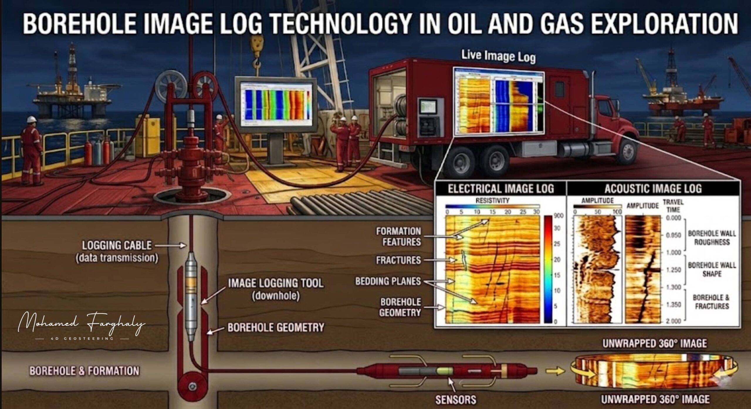
Borehole image log technology gives geosteering teams a detailed visual view of the formation. Instead of relying only on numerical measurements, engineers can examine the wellbore wall and make more accurate well-placement decisions.
How Borehole Image Logs Support Geosteering
Borehole imaging tools create high-resolution images of the wellbore wall. These images reveal bedding planes, fractures, faults, formation textures, and structural changes.
Conventional Logging While Drilling (LWD) tools measure properties such as gamma ray, resistivity, and density. However, image logs provide additional structural information. Geosteerers can use this information to identify formation dip, dip direction, and bed orientation.
As a result, the team can understand the geological structure around the well more clearly. They can also adjust the trajectory before the well leaves the target reservoir zone.
This technology offers significant value in thin, faulted, or highly fractured reservoirs. Even a small structural change can move a horizontal well outside the productive interval. Therefore, early detection helps geosteerers protect reservoir exposure and improve drilling accuracy.
Integrating Borehole Imaging with MWD and LWD
Borehole imaging becomes more powerful when teams combine it with Measurement While Drilling (MWD) and LWD data. Each technology provides a different part of the subsurface picture:
- MWD tracks the well trajectory and drilling direction.
- LWD measures the physical properties of the formation.
- Image logs show structural and geological features.
Together, these measurements create a stronger geosteering workflow. For example, an image log may reveal a change in bedding angle. The geosteering team can compare this feature with resistivity responses and directional surveys. Then, they can determine whether the well is approaching a formation boundary.
Image logs also help identify natural fractures and stress patterns. These features can affect drilling stability, fluid flow, and reservoir productivity. Therefore, understanding their location and orientation supports safer drilling and better well placement.
Improving Well-Placement Decisions
Some drilling teams focus mainly on numerical logs. However, visual formation data can reveal features that standard curves may not show clearly.
Borehole image log technology transforms complex measurements into an interpretable view of the subsurface. Consequently, geosteerers can recognize structural changes faster and make decisions with greater confidence.
When combined with MWD, LWD, and geological models, borehole imaging improves trajectory control and reservoir understanding. It helps teams maintain the well inside the target zone while responding quickly to unexpected geological changes.
For geosteering operations that require greater precision, borehole image log technology provides the structural clarity needed for smarter and more confident decisions.
🔗 Keywords
Drilling Rig, Drilling Mud, MWD, LWD, Directional Drilling, Geosteering, Well Placement, Oil Reservoir, Surface Logging, Borehole Imaging, Electromagnetic Resistivity LWD Tool, Bottom Hole Assembly, Study of Real-Time LWD Data, LWD Interpretation, Borehole Image Log, Dip Calculation Methods, Shale Gas Sweet Spot, Accurate Reservoir Boundary Detection, Machine Learning, Artificial Intelligence, The Future of Automated Geosteering, Ensemble-Based Well Log Interpretation, Digital Twins in Drilling, Remote Operations Centers
