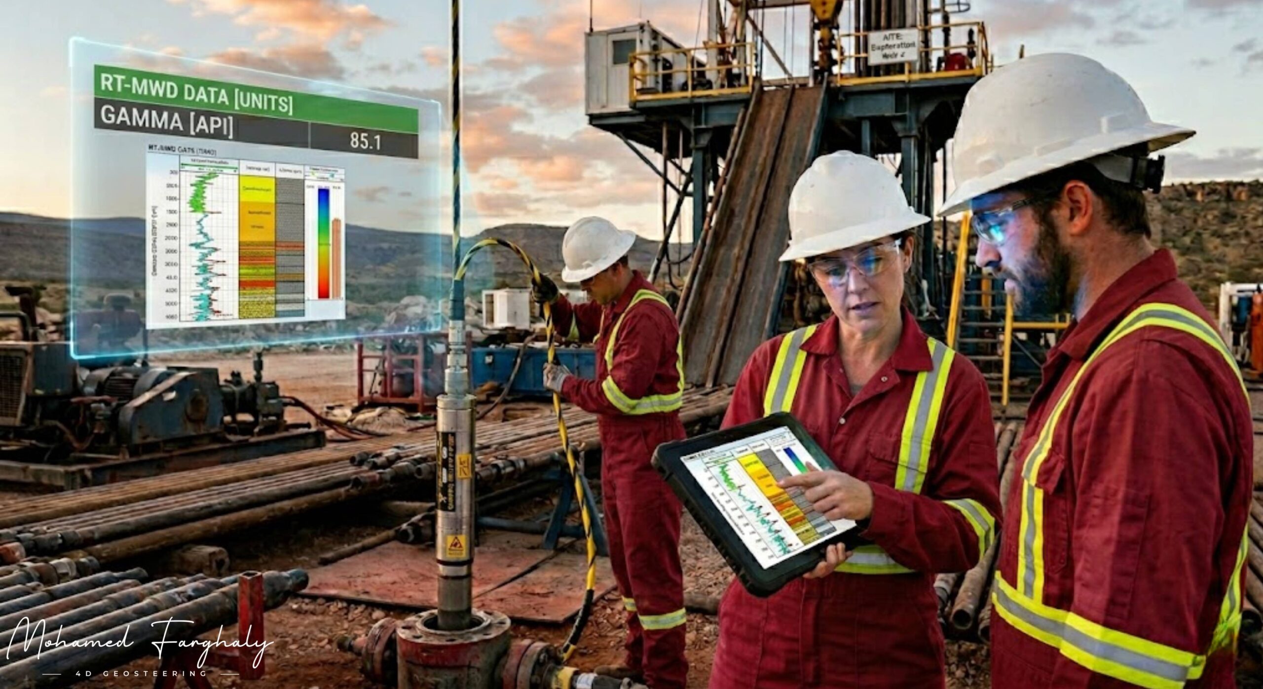
Gamma Ray Sensors: Reading the Earth’s Natural Fingerprints
Nov 13, 2024 · 2 minutes reading
Every rock underground carries a kind of natural signature—an invisible fingerprint formed over millions of years. In the oil and gas industry, one of the simplest yet most powerful tools for decoding this signature is the Gamma Ray Sensor, a key component of modern Logging While Drilling (LWD) systems.
Gamma Ray measurements are based on detecting natural radioactivity emitted by formations, mainly from potassium, uranium, and thorium. Different rock types emit different levels of radiation, which allows engineers to distinguish between lithologies while drilling. Shales typically show high gamma ray values, while cleaner formations like sandstones and carbonates show much lower readings. This contrast is essential for identifying formation boundaries in real time.
Placed within the Bottom Hole Assembly, Gamma Ray Sensors continuously collect data as the Drilling Rig penetrates deeper into the subsurface. This real-time measurement plays a major role in Directional Drilling and Well Placement, helping engineers understand exactly which formation the bit is currently drilling through.
One of the most important applications of gamma ray data is in Geosteering. As the well is drilled horizontally, even small changes in gamma ray readings can indicate that the well is moving closer to or away from the target zone within the Oil Reservoir. This allows drilling teams to make immediate adjustments and stay within the most productive interval, avoiding unwanted shale barriers or water-bearing zones.
When combined with other LWD measurements, gamma ray data becomes even more powerful. It supports LWD Interpretation by helping correlate lithology changes with resistivity and density readings. It is also widely used in the Study of Real-Time LWD Data, where continuous monitoring helps detect formation shifts and refine the geological model while drilling is in progress.
In complex reservoirs, gamma ray trends are often used alongside Borehole Imaging and Borehole Image Log data to improve structural understanding. This integration helps identify subtle changes in stratigraphy and supports Accurate Reservoir Boundary Detection. In some cases, it also contributes to identifying sweet spots, including a Shale Gas Sweet Spot, where organic-rich formations show distinct gamma signatures.
Modern workflows often integrate gamma ray data with MWD, Surface Logging, and advanced analytics such as Machine Learning and Artificial Intelligence. These technologies enhance pattern recognition and improve interpretation speed. In Remote Operations Centers, experts use this data to guide real-time decisions, moving the industry closer to The Future of Automated Geosteering.
In the end, Gamma Ray Sensors are more than just measurement tools—they are the earth’s natural language translators. By reading these subtle signals, engineers can understand the subsurface with greater clarity and drill with far more confidence.
🔗 Keywords
Drilling Rig, Drilling Mud, MWD, LWD, Directional Drilling, Geosteering, Well Placement, Oil Reservoir, Surface Logging, Borehole Imaging, Electromagnetic Resistivity LWD Tool, Bottom Hole Assembly, Study of Real-Time LWD Data, LWD Interpretation, Borehole Image Log, Dip Calculation Methods, Shale Gas Sweet Spot, Accurate Reservoir Boundary Detection, Machine Learning, Artificial Intelligence, The Future of Automated Geosteering, Ensemble-Based Well Log Interpretation, Digital Twins in Drilling, Remote Operations Centers
