LWD Interpretation
March 5, 2025 · 2 minutes reading
What if the success of geosteering depends not on the tools themselves, but on how well you interpret the data? That is exactly what LWD interpretation represents — the foundation of precise and effective geosteering decisions.
In modern drilling operations, Logging While Drilling (LWD) provides continuous real-time data from the formation. However, in geosteering, the true value lies in how this data is interpreted. Without accurate LWD interpretation, even the most advanced tools cannot deliver reliable geosteering results.
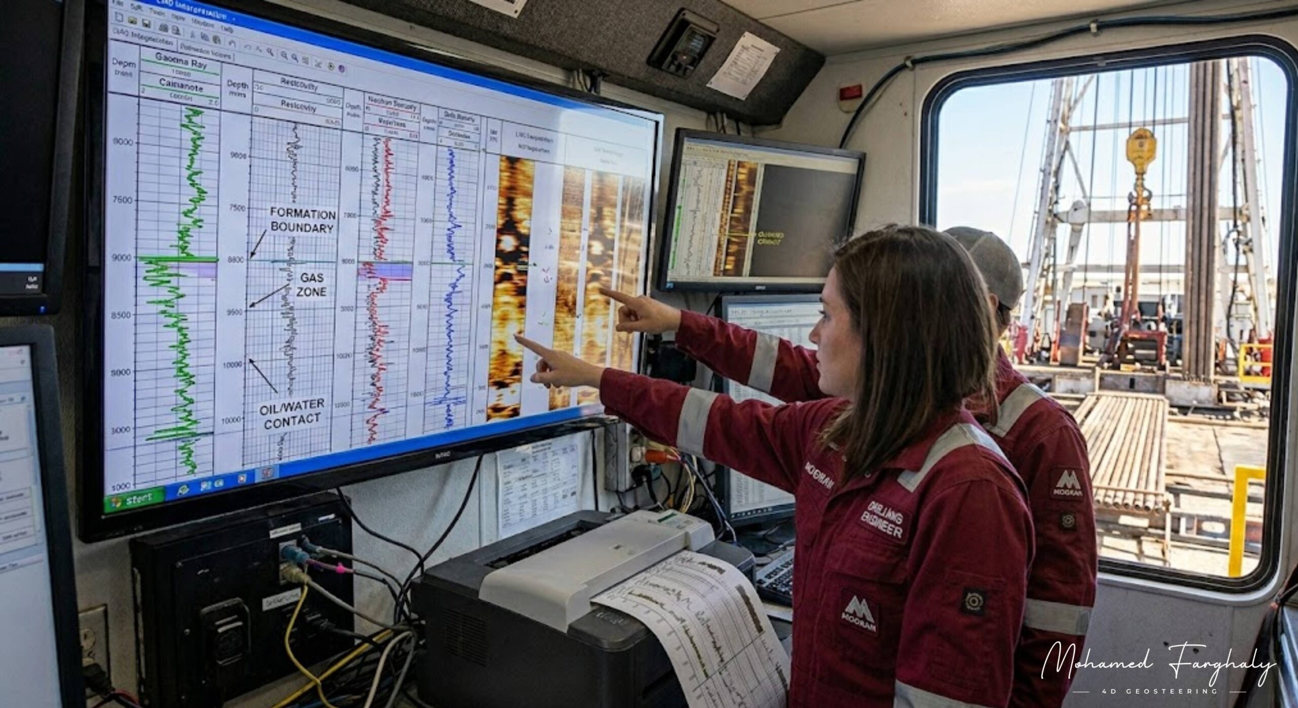
LWD interpretation in geosteering involves analyzing measurements such as resistivity, gamma ray, density, and neutron porosity to understand lithology, fluid distribution, and formation boundaries. These insights are essential for maintaining accurate geosteering and ensuring optimal well placement.
This becomes even more critical in directional drilling and horizontal wells, where geosteering requires continuous monitoring and adjustment. A small error in LWD interpretation can lead to incorrect geosteering decisions, causing the well to move away from the most productive zone.
When combined with Measurement While Drilling (MWD), LWD interpretation becomes the driving force behind real-time geosteering operations. MWD provides the trajectory, while LWD interpretation provides the geological understanding needed for accurate geosteering. Together, they enable consistent and controlled geosteering decisions.
The strength of geosteering relies heavily on the quality of LWD interpretation. By identifying subtle formation changes, detecting fluid contacts, and recognizing reservoir boundaries early, geosteerers can improve geosteering accuracy and maintain control of the well path.
Many focus on tools and technology, but in reality, geosteering success depends on interpretation skills. The ability to understand and act on real-time LWD data is what transforms geosteering into a proactive, data-driven process.
If you want to master geosteering and improve well placement precision, start with LWD interpretation. It is where data becomes insight and insight becomes accurate geosteering decisions.
🔗 Keywords
Drilling Rig, Drilling Mud, MWD, LWD, Directional Drilling, Geosteering, Well Placement, Oil Reservoir, Surface Logging, Borehole Imaging, Electromagnetic Resistivity LWD Tool, Bottom Hole Assembly, Study of Real-Time LWD Data, LWD Interpretation, Borehole Image Log, Dip Calculation Methods, Shale Gas Sweet Spot, Accurate Reservoir Boundary Detection, Machine Learning, Artificial Intelligence, The Future of Automated Geosteering, Ensemble-Based Well Log Interpretation, Digital Twins in Drilling, Remote Operations Centers
