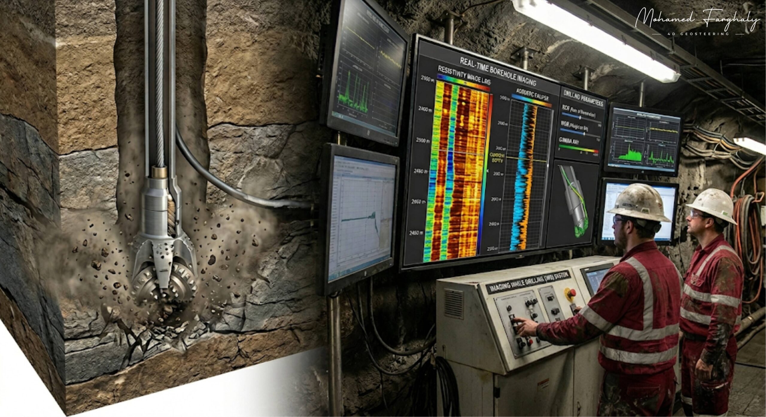
Borehole Imaging
Feb 14, 2025· 2 minutes reading
Accurate geosteering is not only about tracking the well path — it is about understanding the structure of the formation in real time. That’s where Borehole Imaging plays a key role, enhancing geosteering by providing a clear structural view of the subsurface.
In drilling and geosteering operations, borehole imaging tools generate high-resolution images of the wellbore wall. These images reveal important geological features such as bedding planes, fractures, and faults, all of which directly impact geosteering decisions and Well Placement within the Oil Reservoir.
Unlike standard Logging While Drilling (LWD) measurements, which provide indirect data like resistivity or gamma ray, borehole imaging adds a structural perspective to geosteering. It helps determine dip angle, dip direction, and formation orientation — key inputs for accurate trajectory control during geosteering.
This becomes especially important in complex reservoirs, where geosteering must navigate thin beds or fractured zones. Small structural changes can affect well performance, and borehole imaging helps detect them early, allowing real-time geosteering adjustments.
When integrated with Measurement While Drilling (MWD) and LWD, borehole imaging strengthens the entire geosteering workflow. MWD defines the well path, LWD evaluates the formation, and imaging explains the structure — enabling more confident geosteering decisions.
Advanced techniques like Dip Calculation Methods further improve interpretation, while modern tools powered by Machine Learning and Artificial Intelligence are enhancing data analysis and supporting the future of automated geosteering.
In simple terms, borehole imaging is a key enabler of modern geosteering, turning subsurface data into clear structural insight and helping achieve more accurate and efficient drilling.
If you want to understand how geosteering, structural geology, and well placement optimization come together, start with borehole imaging. It’s the closest thing to seeing the reservoir with your own eyes.
🔗 Keywords
Drilling Rig, Drilling Mud, MWD, LWD, Directional Drilling, Geosteering, Well Placement, Oil Reservoir, Surface Logging, Borehole Imaging, Electromagnetic Resistivity LWD Tool, Bottom Hole Assembly, Study of Real-Time LWD Data, LWD Interpretation, Borehole Image Log, Dip Calculation Methods, Shale Gas Sweet Spot, Accurate Reservoir Boundary Detection, Machine Learning, Artificial Intelligence, The Future of Automated Geosteering, Ensemble-Based Well Log Interpretation, Digital Twins in Drilling, Remote Operations Centers
