Method for Accurate Reservoir Boundary Detection
November 7, 2025 · 2 minutes reading
What if the difference between a successful well and a poor one is simply how early you detect a boundary? In geosteering, this is exactly what defines performance — and that is why accurate reservoir boundary detection is one of the most critical skills in modern drilling.
In geosteering operations, reservoir boundaries are not just geological lines — they are real-time decision points. Detecting the top and base of the reservoir early allows geosteerers to adjust the well trajectory and maintain optimal well placement inside the target zone.
The main methods for reservoir boundary detection in geosteering rely heavily on real-time LWD data. Changes in gamma ray, resistivity, and density logs help identify lithology transitions that signal approaching boundaries. These subtle changes are the foundation of accurate geosteering interpretation.
In directional drilling and horizontal wells, boundary detection becomes even more important. A slight delay in recognizing a formation change can push the well outside the reservoir, reducing production efficiency. This is why continuous monitoring is essential in geosteering workflows.
When combined with Measurement While Drilling (MWD), boundary detection becomes more powerful. MWD provides the well trajectory, while LWD responses define formation changes. Together, they form the backbone of accurate geosteering decisions and controlled well placement.
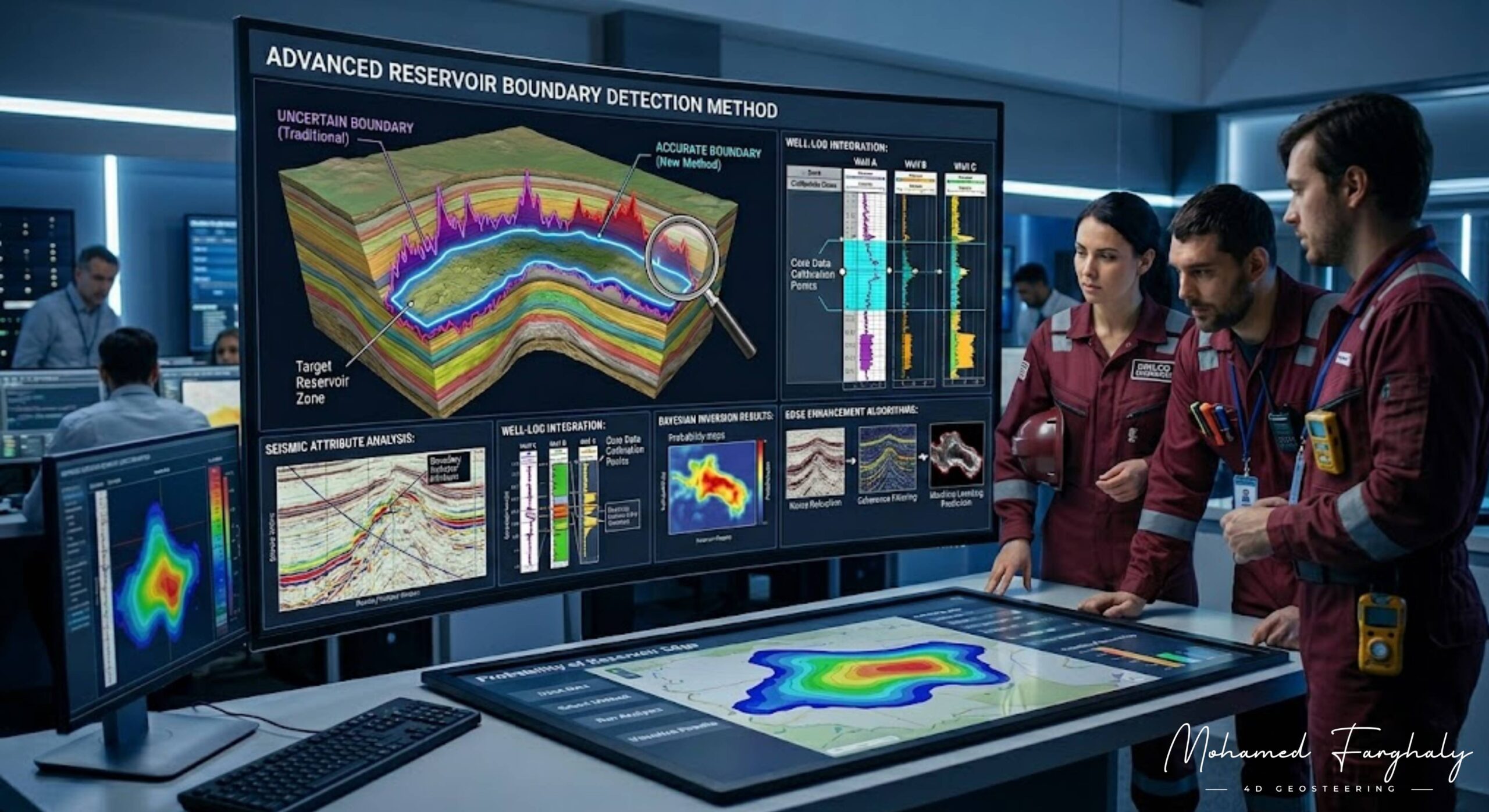
Advanced geosteering methods also include pattern recognition, offset well correlation, and integration with borehole image logs to improve confidence in identifying reservoir limits. These techniques reduce uncertainty and improve real-time geosteering accuracy.
Many underestimate the importance of boundary detection in geosteering, focusing only on staying inside the reservoir. However, true success in geosteering depends on knowing exactly where the boundaries are and reacting before the well crosses them.
If you want to improve geosteering performance and achieve precise well placement, mastering reservoir boundary detection methods is essential. It is one of the most important foundations of successful geosteering operations.
🔗 Keywords
Drilling Rig, Drilling Mud, MWD, LWD, Directional Drilling, Geosteering, Well Placement, Oil Reservoir, Surface Logging, Borehole Imaging, Electromagnetic Resistivity LWD Tool, Bottom Hole Assembly, Study of Real-Time LWD Data, LWD Interpretation, Borehole Image Log, Dip Calculation Methods, Shale Gas Sweet Spot, Accurate Reservoir Boundary Detection, Machine Learning, Artificial Intelligence, The Future of Automated Geosteering, Ensemble-Based Well Log Interpretation, Digital Twins in Drilling, Remote Operations Centers
