Dip Calculation Methods
August 9, 2025 · 3 minutes reading
What if one small miscalculation in formation dip could shift your entire geosteering decision? That is exactly why understanding dip calculation methods is critical for achieving accurate and reliable geosteering operations.
In modern drilling, dip calculation is a key part of geosteering because it defines how geological layers are oriented in the subsurface. By determining dip angle and dip direction, geosteerers can understand how the formation is positioned relative to the wellbore and make better geosteering decisions.
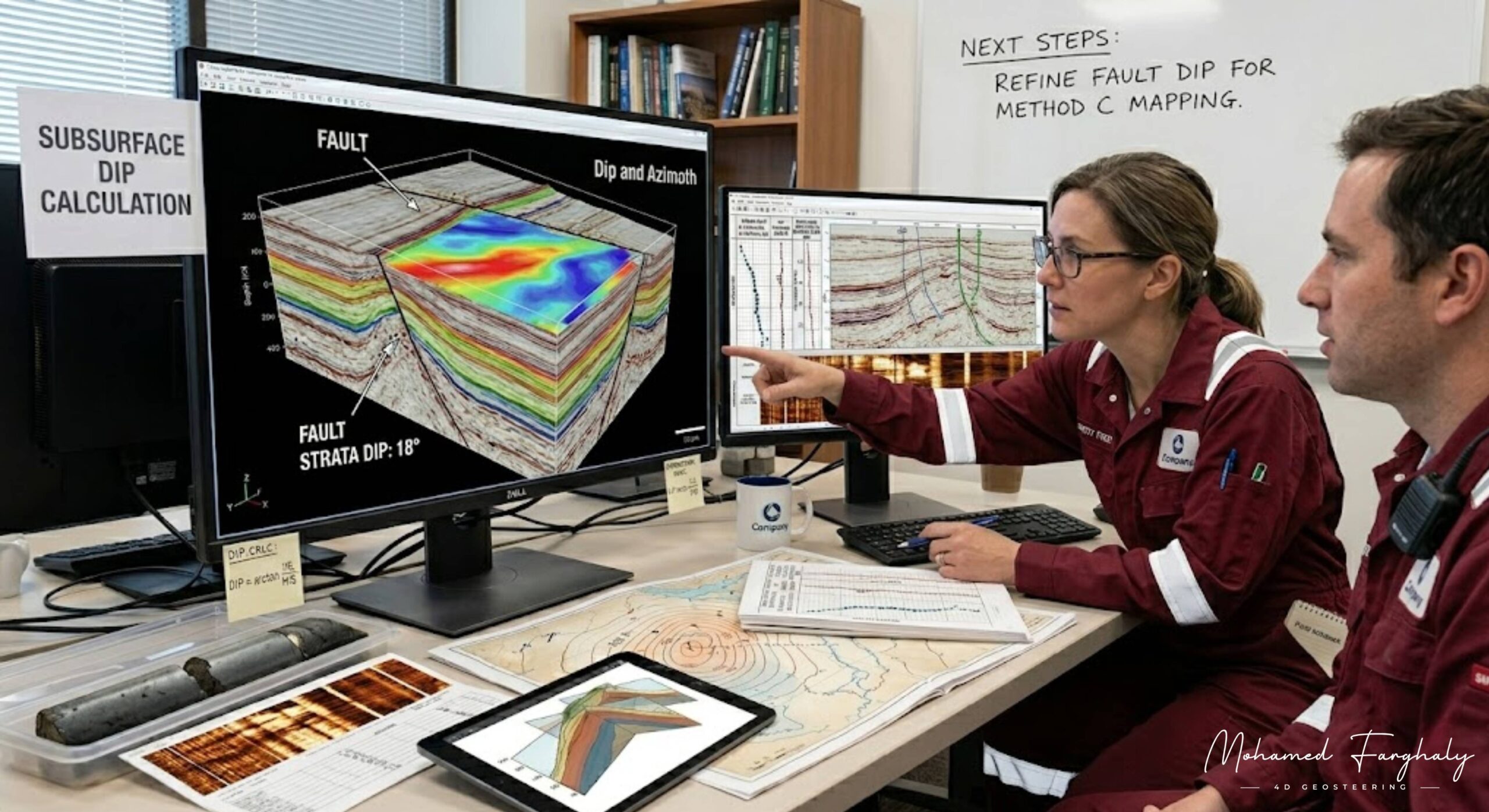
Dip calculation methods in geosteering rely on multiple data sources, including Logging While Drilling (LWD) measurements, resistivity responses, and borehole image data. These inputs are analyzed to estimate formation boundaries and predict how the reservoir extends ahead of the bit. Accurate dip estimation is essential for maintaining optimal well placement.
In directional drilling and horizontal wells, the importance of dip increases significantly. Even a small error in dip interpretation can cause incorrect geosteering adjustments, leading the well away from the target zone. This is why continuous refinement of dip calculations is required throughout the geosteering process.
When combined with Measurement While Drilling (MWD), dip calculation methods become even more powerful for geosteering. MWD provides the well trajectory, while dip calculations define the orientation of the formation. Together, they allow geosteerers to align the well path with the reservoir structure and improve geosteering accuracy.
Advanced geosteering workflows use multiple dip estimation techniques, including structural correlation, real-time log interpretation, and image-based analysis. These methods help reduce uncertainty and improve confidence in geosteering decisions, especially in complex geological environments.
Many underestimate the importance of dip in geosteering, focusing only on staying within the reservoir. However, true geosteering precision comes from understanding how the reservoir is oriented and how the well should move relative to it.
If you want to improve your geosteering skills and achieve better well placement, start with mastering dip calculation methods. It is the key to aligning the well with the structure and making accurate geosteering decisions.
🔗 Keywords
Drilling Rig, Drilling Mud, MWD, LWD, Directional Drilling, Geosteering, Well Placement, Oil Reservoir, Surface Logging, Borehole Imaging, Electromagnetic Resistivity LWD Tool, Bottom Hole Assembly, Study of Real-Time LWD Data, LWD Interpretation, Borehole Image Log, Dip Calculation Methods, Shale Gas Sweet Spot, Accurate Reservoir Boundary Detection, Machine Learning, Artificial Intelligence, The Future of Automated Geosteering, Ensemble-Based Well Log Interpretation, Digital Twins in Drilling, Remote Operations Centers
