How Integrated Geosteering Improves Drilling Decisions
Dec 17, 2023· 2 minutes reading
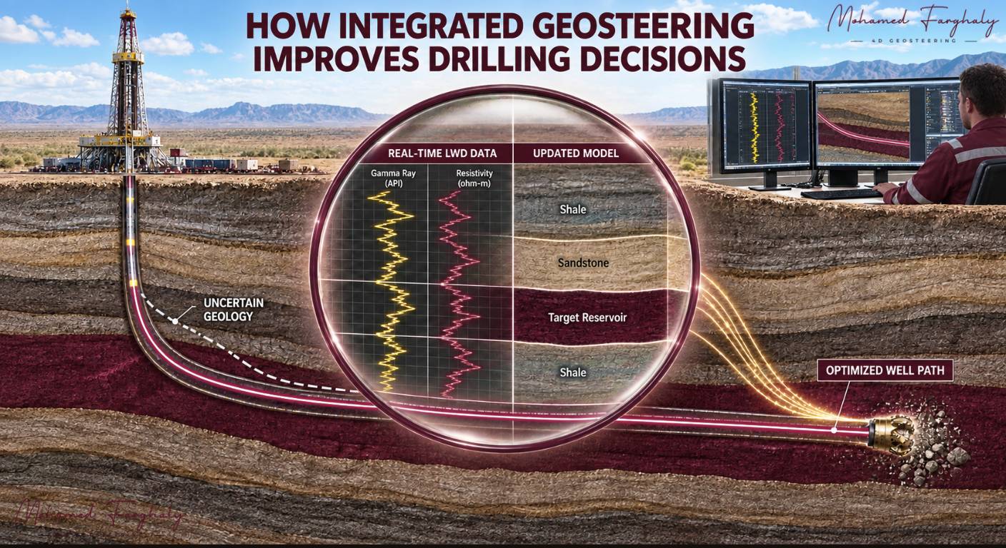
Drilling teams must make important decisions while the bit continues moving through an uncertain subsurface. Integrated geosteering supports this process by connecting real-time measurements, geological interpretations and directional information in one coordinated workflow. As a result, the team can understand the well’s position and react quickly when conditions change.
Instead of reviewing disconnected screens or manually transferring files, specialists work from the same updated information. Therefore, geologists, LWD engineers and directional drillers can communicate more clearly and make better-supported drilling decisions.
Connecting Real-Time Data With the Geological Model
An integrated geosteering system receives continuous information from multiple sources. These inputs may include gamma ray, resistivity, inclination, azimuth, toolface and drilling parameters. In addition, the system uses offset-well logs, formation markers and the planned trajectory to build geological context around the incoming data.
First, the team checks the measurements for correct depth, time, units and quality. This step is essential because delayed or incorrectly aligned data can create a false geological picture.
Next, geologists correlate the real-time log response with the expected formation sequence. If the actual response differs from the pre-drill interpretation, they can update formation boundaries, structural dip or fault positions. Consequently, the model reflects the geology encountered by the drill bit instead of relying only on initial assumptions.
Furthermore, combining geological and directional information helps the team determine whether the well is approaching the reservoir roof, floor or another critical boundary.
Supporting Faster and Better Drilling Decisions
Integrated geosteering becomes valuable when it turns new information into a clear operational response. For example, the logs may indicate that the well is moving closer to the reservoir floor. At the same time, directional measurements may show that the current trajectory will continue toward that boundary.
The team can then compare the well path with the updated geological model. Based on this interpretation, geosteering specialists may recommend holding, building or dropping inclination. However, directional drillers must also confirm that the proposed adjustment is operationally achievable.
Because everyone sees the same information, the team spends less time reconciling separate datasets. Moreover, they can detect formation changes earlier, evaluate uncertainty and document each decision more effectively.
Nevertheless, integration does not replace professional judgement. Geologists still need to assess data quality, while drilling specialists must consider tool limits and wellbore conditions. Human review remains essential before the team applies any trajectory change.
Ultimately, integrated geosteering improves drilling decisions by connecting measurements, interpretation and action. It creates a faster and more reliable workflow that helps teams keep the well inside the target interval and maximize valuable reservoir contact.
🔗 Keywords
Drilling Rig, Drilling Mud, MWD, LWD, Directional Drilling, Geosteering, Well Placement, Oil Reservoir, Surface Logging, Borehole Imaging, Electromagnetic Resistivity LWD Tool, Bottom Hole Assembly, Study of Real-Time LWD Data, LWD Interpretation, Borehole Image Log, Dip Calculation Methods, Shale Gas Sweet Spot, Accurate Reservoir Boundary Detection, Machine Learning, Artificial Intelligence, The Future of Automated Geosteering, Ensemble-Based Well Log Interpretation, Digital Twins in Drilling, Remote Operations Centers