Integration with Drilling Operations: Real-Time Team Workflows
April 10, 2023· 2 minutes reading
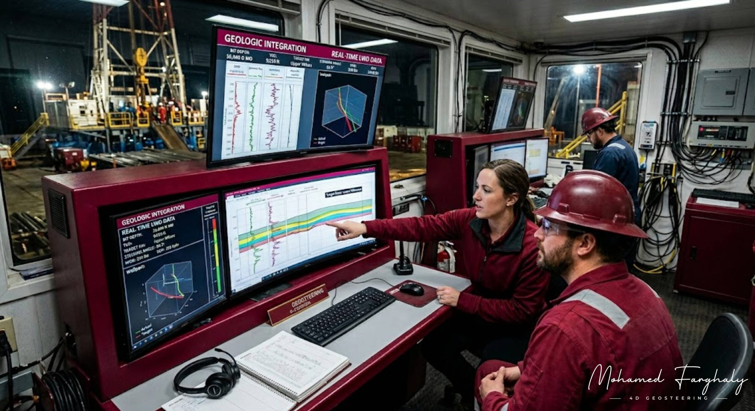
Integration with drilling operations means connecting geology, geophysics, and drilling engineering into one continuous workflow during well execution. Instead of each discipline working separately,sset teams share all data and decisions in real time. This collaborative effort guides the well toward the target zone efficiently.
Before drilling begins, integration starts in the planning phase. Geoscientists and drilling engineers work together to build the geological and structural model, design the well trajectory, identify possible drilling risks such as faults or pressure zones, and select the appropriate drilling tools and Bottom Hole Assembly (BHA). This early coordination ensures that everyone involved in the operation is aligned with the same subsurface understanding and drilling plan.
During drilling, real-time data becomes the key element of integration. Tools such as MWD and LWD continuously transmit information to the surface. This data includes wellbore direction, inclination, and formation properties. This includes wellbore direction (inclination and azimuth), formation properties such as gamma ray, resistivity, and density, as well as drilling performance indicators like rate of penetration, torque, and weight on bit. All this information is shared instantly between the drilling and geology teams.
At this stage, continuous communication between teams is critical. Geologists and drilling engineers work together to build the geological model. During this phase, they design the well trajectory and identify possible drilling risks such as faults. Finally, they select the appropriate tools. Based on this interpretation, they decide whether any adjustments to the well path are needed.
The rig crew immediately translates these engineering decisions into physical action at the site. Drilling engineers adjust parameters such as toolface orientation, inclination, azimuth, drilling speed, and weight on bit to correct the well trajectory. This ensures that the crew applies geological interpretation directly to physical drilling operations.
Integration with drilling operations is important because it improves well placement accuracy, reduces geological uncertainty, minimizes non-productive time, helps avoid drilling into unwanted formations, and increases reservoir exposure and overall efficiency.
🔗 Keywords
Drilling Rig, Drilling Mud, MWD, LWD, Directional Drilling, Geosteering, Well Placement, Oil Reservoir, Surface Logging, Borehole Imaging, Electromagnetic Resistivity LWD Tool, Bottom Hole Assembly, Study of Real-Time LWD Data, LWD Interpretation, Borehole Image Log, Dip Calculation Methods, Shale Gas Sweet Spot, Accurate Reservoir Boundary Detection, Machine Learning, Artificial Intelligence, The Future of Automated Geosteering, Ensemble-Based Well Log Interpretation, Digital Twins in Drilling, Remote Operations Centers
