• Tool Placement in BHA in Geosteering

    May 8, 2023· 2 minutes reading

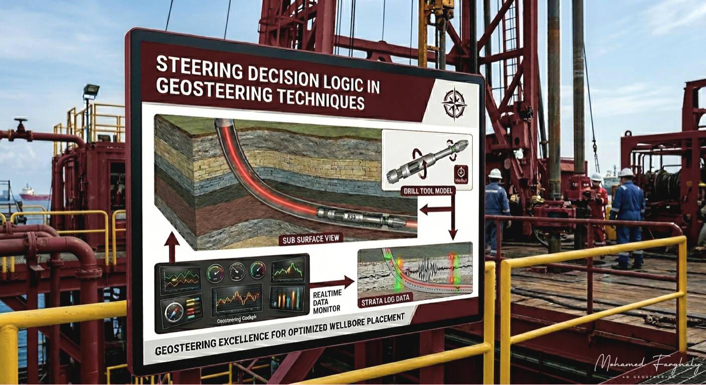
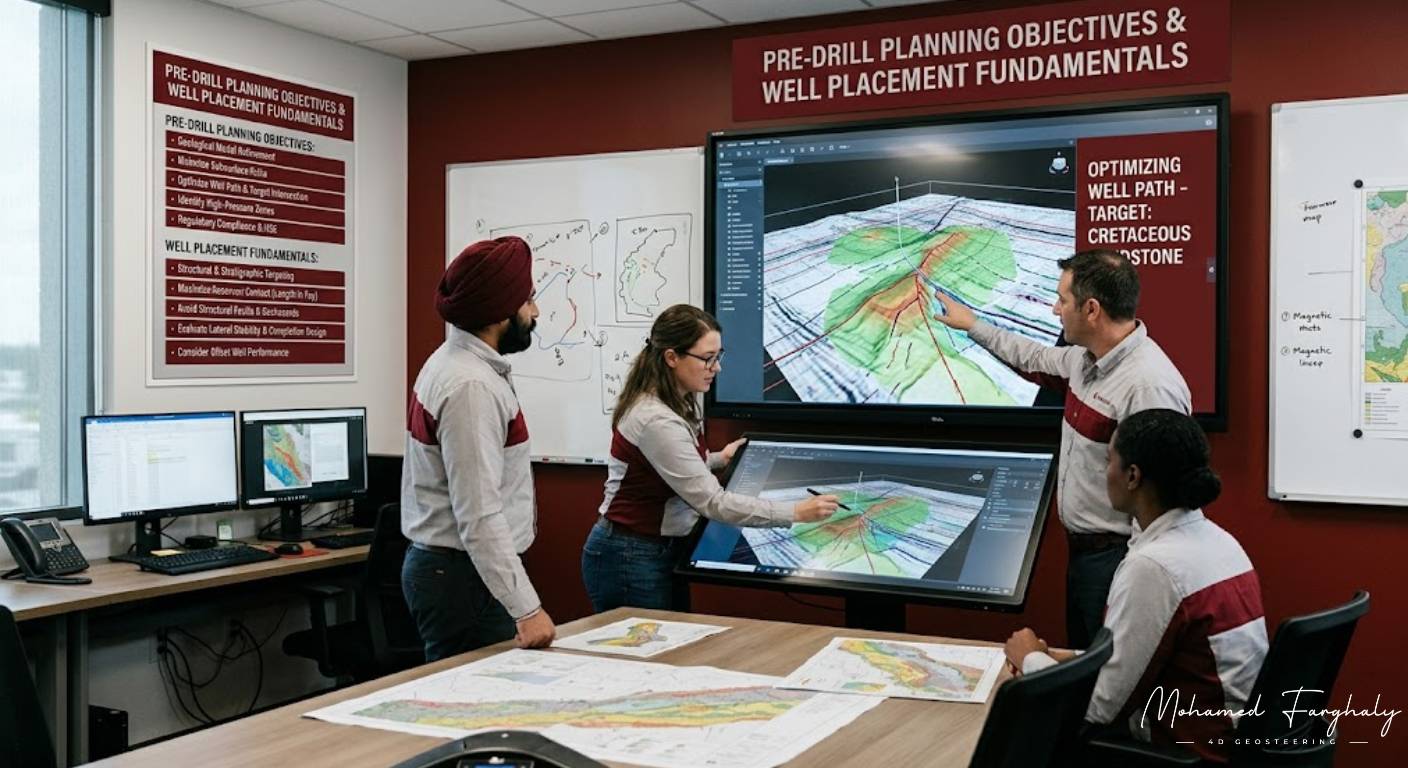
    In modern geosteering operations, success is not determined only by the quality of geological interpretation or the accuracy of formation evaluation. One of the most critical factors behind precise well placement is tool placement inside the Bottom Hole Assembly (BHA). The position of each measurement tool relative to the drill bit directly affects how quickly the drilling team detects formation changes and reacts to them in real time.

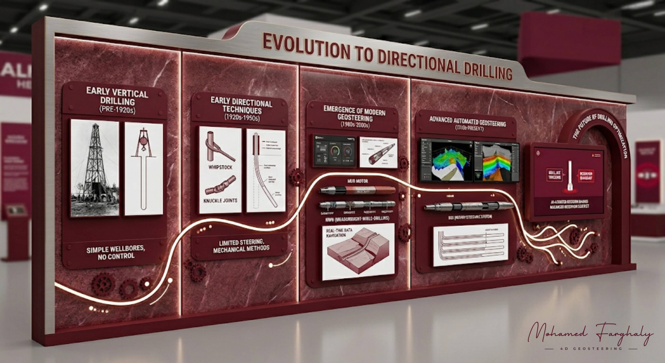
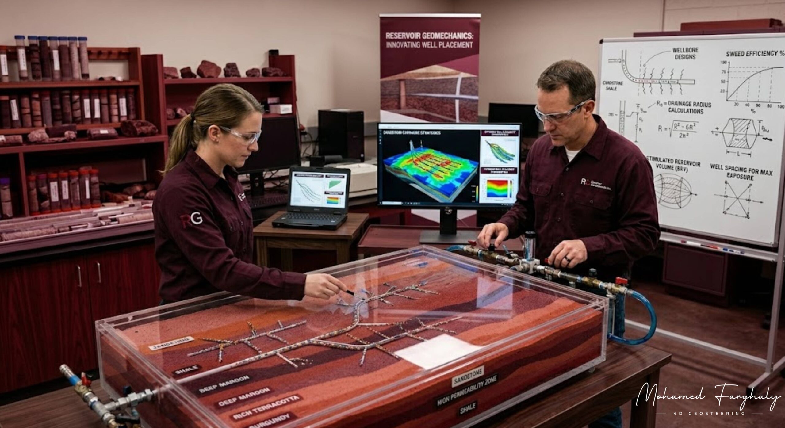
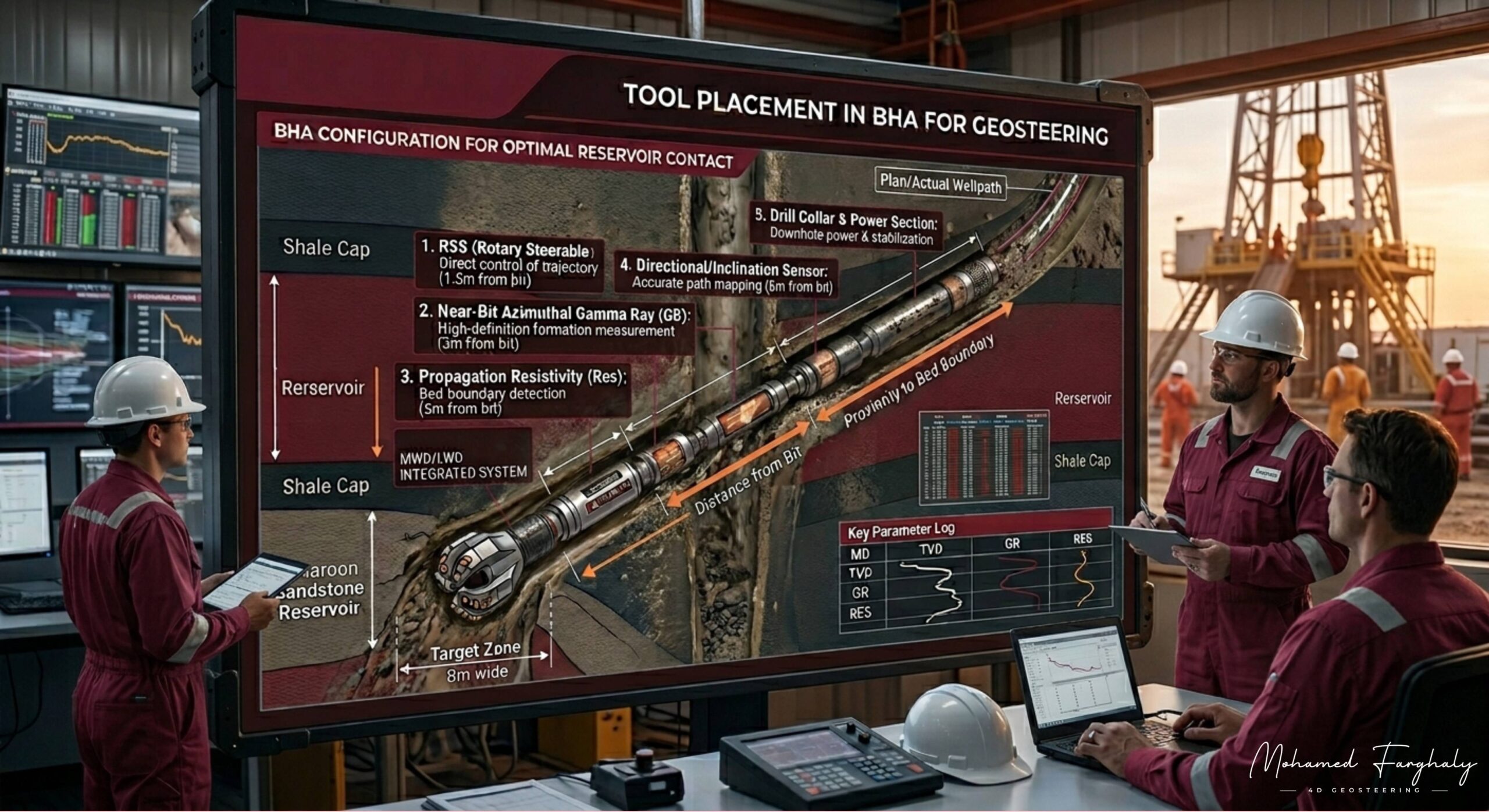
    The Bottom Hole Assembly (BHA) is the lower section of the drill string that includes the drill bit, motors, stabilizers, and measurement tools such as MWD (Measurement While Drilling) and LWD (Logging While Drilling) sensors. In geosteering, the placement of these tools determines whether the team receives early warnings about formation boundaries or delayed information after the bit has already exited the target zone.

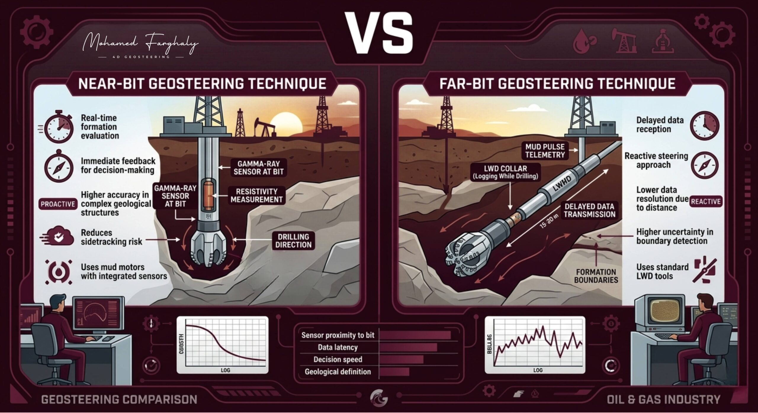
    One of the most important concepts in BHA design is the difference between near-bit and far-bit sensor placement. Near-bit tools are positioned very close to the drill bit, sometimes only a few feet away. This setup allows geosteering teams to detect lithology changes almost immediately, reducing reaction time and improving steering precision in thin reservoirs. Near-bit measurements are especially valuable in highly complex formations where rapid geological decisions are required.

    On the other hand, far-bit tools are located farther behind the bit in the BHA. Although they may provide higher-quality or more stable measurements, the data arrives later because the bit has already drilled ahead before the formation is evaluated. This delay can increase the risk of exiting the reservoir before corrective steering actions are taken.

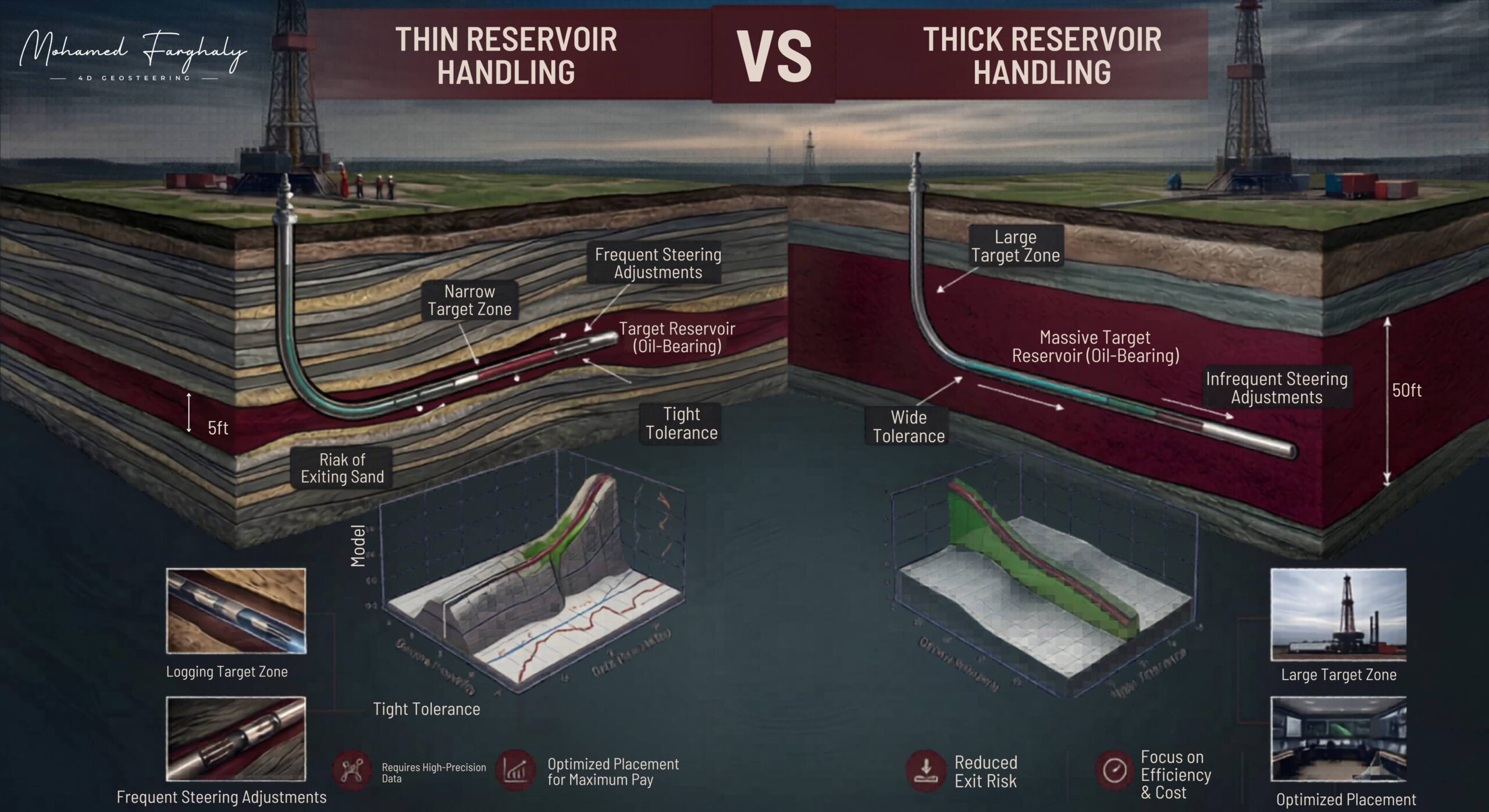
    The placement of tools also depends on the drilling objective and reservoir characteristics. In thin reservoirs, operators often prefer near-bit gamma ray or resistivity tools to maximize wellbore exposure within the productive zone. In thicker formations, slightly farther tool placement may still provide sufficient reaction time while improving data reliability.

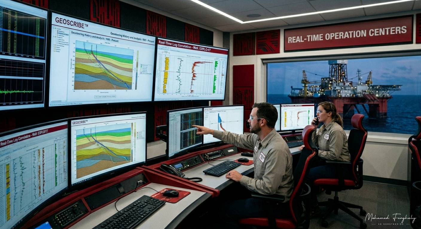
    Modern geosteering operations carefully optimize BHA configurations to balance measurement accuracy, response time, drilling efficiency, and well placement precision. As drilling technologies continue to evolve, intelligent BHA designs are becoming essential for reducing uncertainty and improving reservoir navigation in increasingly challenging wells.


    🔗 Keywords


  • Near-bit vs far-bit techniques comparison

    May 6, 2023· 2 minutes reading

    In modern geosteering, one of the biggest challenges is understanding where the wellbore is heading before the drill bit exits the target zone. This is where near-bit and far-bit measurement techniques become essential. Both methods help geosteering teams make real-time steering decisions, but they provide different levels of visibility into the formation ahead of the bit.

    What Are Near-Bit Techniques?

    Near-bit measurements are taken very close to the drill bit, sometimes only a few feet behind it. These measurements provide immediate information about the formation currently being drilled. Because the sensors are close to the bit, the response is fast and highly accurate for identifying lithology changes, bed boundaries, and reservoir entry or exit points.

    Near-bit techniques are extremely valuable in thin reservoirs, where even small trajectory changes can move the well outside the productive zone. Geosteering teams rely on near-bit data for rapid corrections and maintaining precise well placement.

    However, near-bit measurements mainly show what the bit is drilling right now, not what lies ahead. This limits the ability to predict approaching geological changes early.

    What Are Far-Bit Techniques?

    Far-bit techniques look deeper into the formation ahead of the drill bit using advanced resistivity and electromagnetic technologies. Instead of only measuring the current formation, these tools help geosteerers detect approaching boundaries, fluid contacts, or formation changes before the bit reaches them.

    This predictive capability gives drilling teams more time to adjust the trajectory proactively rather than reactively. Far-bit measurements are especially useful in complex structures, faulted reservoirs, and wells requiring long horizontal exposure.

    The tradeoff is that far-bit measurements may have lower resolution compared to near-bit tools and can involve more interpretation uncertainty.

    Near-Bit vs Far-Bit Comparison

    FeatureNear-Bit TechniquesFar-Bit Techniques
    Sensor PositionVery close to the drill bitDeeper investigation ahead of bit
    Main PurposeImmediate formation evaluationPredictive boundary detection
    Response SpeedVery fastSlightly slower interpretation
    Best ForThin reservoirs and precise controlComplex geology and proactive steering
    Data TypeCurrent formationUpcoming formation trends
    Risk ReductionCorrects trajectory quicklyPrevents unexpected exits early

    Why Both Techniques Matter

    In today’s geosteering workflows, operators often combine both methods to achieve better reservoir navigation. Near-bit measurements provide high-confidence real-time positioning, while far-bit technologies improve anticipation of geological changes ahead.

    The combination allows geosteering teams to reduce uncertainty, improve well placement accuracy, minimize non-productive drilling, and maximize reservoir contact. As drilling environments become more complex, integrating both near-bit and far-bit techniques is becoming a major advantage in the oil and gas industry.


    🔗 Keywords


  • Thin vs thick reservoir handling

    May 4, 2023· 3 minutes reading

    One of the biggest challenges in geosteering is understanding how drilling strategy changes between thin reservoirs and thick reservoirs. While both types of reservoirs may contain valuable hydrocarbons, the way they are handled during drilling can be completely different.

    The thickness of a reservoir directly affects well placement, steering sensitivity, operational risk, and the overall level of precision required from the geosteering team. Because of this, geosteerers must constantly adapt their interpretation and steering approach based on reservoir geometry.

    In thick reservoirs, geosteering is generally more forgiving. The target zone provides a larger vertical window, allowing the well to remain inside the reservoir even if small trajectory deviations occur. Minor changes in formation dip, delayed responses from Logging While Drilling (LWD) tools, or slight steering corrections usually do not immediately place the well outside the productive interval.

    This wider target window allows geosteerers to focus more on optimizing lateral placement, maximizing reservoir exposure, and maintaining drilling efficiency. In many cases, thick reservoirs reduce the operational pressure associated with rapid steering corrections because there is more room for adjustment.

    However, thin reservoirs create a completely different environment. In these formations, the distance between the top and bottom boundaries may only be a few feet. A small error in interpretation or a delayed steering response can quickly place the drill bit outside the target zone.

    This is where real-time interpretation becomes critical. Geosteerers working in thin reservoirs must monitor subtle changes in gamma ray, resistivity, and other LWD measurements to detect approaching boundaries as early as possible. Even slight log variations may indicate that the well is moving closer to shale, water zones, or non-productive formations.

    Thin reservoir handling also requires stronger integration between geology, directional drilling, and operational decision-making. Steering corrections must often happen earlier and more proactively compared to thick reservoirs. Instead of reacting after crossing a boundary, geosteerers try to anticipate geological movement ahead of the bit.

    Another major challenge in thin reservoirs is measurement positioning. Since many LWD sensors are positioned behind the bit, there can be a delay between the actual geological change and when it appears on the logs. In a thick reservoir, this delay may have limited impact. In a thin reservoir, even a short delay can significantly affect well placement accuracy.

    Structural complexity also plays a larger role in thin formations. Small changes in formation dip, faulting, or stratigraphic variability can rapidly alter the position of reservoir boundaries. Because of this, geosteerers often update structural interpretations continuously while drilling progresses.

    Modern geosteering software helps improve thin reservoir navigation through advanced visualization, boundary detection, and predictive modeling. Still, experienced geosteerers rely heavily on geological reasoning, pattern recognition, and understanding reservoir behavior in real time.

    In the end, the difference between handling thin and thick reservoirs is not simply about reservoir size. It is about how much precision, anticipation, and real-time adaptability are required to keep the well inside the most productive part of the formation.

    In geosteering, the thinner the reservoir, the more valuable accurate interpretation becomes.


    🔗 Keywords


  • Steering Decision Logic in Geosteering

    May 3, 2023· 2 minutes reading

    In geosteering, every adjustment made while drilling follows a process known as steering decision logic. This is the system of interpretation, analysis, and operational thinking used to decide whether the well should continue its current path, change inclination, adjust azimuth, or hold trajectory inside the target formation.

    Unlike traditional geology workflows that rely heavily on post-drill analysis, geosteering happens in real time. Decisions must often be made within minutes while the drill bit continues advancing through the subsurface. Because of this, steering decisions are based on combining multiple sources of information together rather than depending on a single measurement.

    The first part of steering decision logic begins with analyzing Logging While Drilling (LWD) data. Measurements such as gamma ray, resistivity, density, and neutron logs help geosteerers identify formation changes, approaching boundaries, and reservoir characteristics. These measurements are continuously compared against the planned geological model.

    However, steering decisions are not made from logs alone. Geosteerers also evaluate well trajectory, formation dip, structural uncertainty, drilling trends, and the expected behavior of the reservoir ahead of the bit. In many cases, the goal is not simply to react to data but to predict geological movement before the bit reaches it.

    For example, if resistivity values begin decreasing while gamma ray increases, this may indicate that the well is approaching a shale boundary. The steering decision logic then focuses on determining whether the boundary is temporary, structural, or part of a larger geological shift. Based on this interpretation, the team may decide to steer upward, downward, or maintain the current path.

    One of the most important aspects of steering decision logic is balancing geological interpretation with operational limitations. Even if geology suggests an immediate correction, factors such as dogleg severity, BHA limitations, drilling efficiency, and directional drilling capabilities must also be considered before making trajectory changes.

    In complex reservoirs, steering decisions often involve uncertainty. The subsurface rarely behaves exactly as predicted, which is why experienced geosteerers rely heavily on pattern recognition, geological reasoning, and continuous model updates. Small changes in data trends can completely change the interpretation of reservoir position.

    Modern real-time operations centers use advanced visualization software and automated modeling systems to support steering decisions. These tools help integrate geological models, well paths, and live measurements into a single workflow. However, human interpretation remains essential because geological complexity cannot always be fully predicted by software alone.

    At its core, steering decision logic is the process of transforming real-time subsurface data into actionable drilling decisions. It connects geology, drilling engineering, and operational awareness into one continuous workflow designed to maximize reservoir exposure and improve well placement accuracy.

    In modern geosteering, successful wells are not guided by data alone. They are guided by the quality of the decisions made from that data.


  • Measurement positioning

    May 2, 2023· 2 minutes reading

    In geosteering, every decision depends on data. But one critical detail is often overlooked by beginners: where that data is actually being measured from. This is the foundation of measurement positioning.

    During drilling, measurements are not always taken directly at the drill bit. In many cases, the sensors inside the Bottom Hole Assembly (BHA) are positioned several feet behind the bit. While this may sound like a small technical detail, it can significantly affect how geosteering decisions are made in real time.

    When a formation boundary appears on a log, the drilling bit may have already moved beyond that exact point. This creates what geosteering teams call a measurement lag. Understanding this lag is essential because accurate well placement depends on predicting where the bit currently is relative to the reservoir, not only where the sensors recorded the data.

    Different Logging While Drilling (LWD) tools have different sensor positions. Gamma ray sensors, resistivity tools, density measurements, and neutron tools may all sit at different distances from the bit. Some tools are positioned very close to the bit for faster geological response, while others are placed farther back due to design limitations or measurement requirements.

    This is why geosteering is not simply reading logs on a screen. It requires continuous interpretation of how measurements relate to actual bit position, drilling direction, formation dip, and reservoir geometry.

    Measurement positioning becomes even more critical in thin reservoirs and highly complex formations. A delay of only a few feet can mean exiting the target zone before the geosteering team recognizes the change. In horizontal wells, where maintaining precise placement inside the reservoir is critical for production performance, understanding sensor offsets can directly impact drilling success.

    Modern geosteering workflows often include software that automatically compensates for sensor positions and calculates true geological placement in real time. However, experienced geosteerers still rely heavily on geological reasoning, structural understanding, and operational awareness to validate what the software predicts.

    As real-time operations continue to evolve, measurement positioning remains one of the most important concepts in accurate geosteering. The quality of decisions depends not only on the data itself, but also on understanding exactly where that data comes from relative to the drilling bit.

    In geosteering, precision is not just about measurements. It is about positioning those measurements correctly within the subsurface story being drilled minute by minute.


  • AI-assisted geosteering

    May 1, 2023 ·3 minutes reading

    What if a drilling team could predict geological changes before the drill bit even reached them? What if thousands of real-time measurements could be analyzed instantly to support faster and more accurate steering decisions? This is the direction modern geosteering is moving toward with the rise of Artificial Intelligence.

    As drilling operations became more data-intensive, geosteering teams began facing a major challenge. Modern wells generate enormous amounts of real-time information from MWD, LWD, mud logging, drilling parameters, formation evaluation tools, and geological models. Interpreting all of this data quickly while drilling continues is extremely demanding, especially in complex reservoirs where small steering decisions can significantly impact well performance.

    To help manage this growing complexity, the industry started integrating Artificial Intelligence into geosteering workflows.

    AI-assisted geosteering does not replace geologists or geosteerers. Instead, it enhances decision-making by helping teams process data faster, recognize patterns earlier, and reduce uncertainty during drilling operations. Machine learning algorithms can analyze large volumes of geological and drilling data in real time, identify trends, compare current measurements with offset wells, and support trajectory recommendations while the well is still being drilled.

    One of the biggest advantages of AI-assisted geosteering is speed. In traditional workflows, geological interpretation often depends heavily on manual analysis and continuous human monitoring. AI systems can rapidly evaluate incoming data streams and highlight potential formation changes, approaching boundaries, or unexpected drilling behavior much earlier than conventional methods alone.

    This becomes especially valuable in thin reservoirs and highly complex formations where maintaining accurate well placement is critical. AI models can assist in predicting structural behavior ahead of the bit, estimating formation tops, and identifying subtle changes in real-time resistivity or gamma ray responses that may indicate movement toward reservoir boundaries.

    Another major advancement is the use of predictive analytics. Instead of reacting only to current measurements, AI-assisted systems can forecast possible geological scenarios ahead of the well path. This gives geosteering teams more time to evaluate options and make proactive decisions before problems occur.

    AI is also improving operational consistency. In large drilling campaigns involving multiple wells, AI-assisted systems can help standardize interpretation workflows, reduce repetitive manual tasks, and support faster collaboration between geologists, drilling engineers, and real-time operation centers.

    As digital technologies continue to evolve, AI-assisted geosteering is becoming more integrated with 3D geological modeling, cloud-based data systems, and automated drilling optimization platforms. Modern workflows are moving toward environments where real-time geological interpretation, predictive modeling, and operational analytics work together continuously during drilling.

    Despite these advancements, human expertise remains essential. Geological reasoning, structural understanding, regional experience, and operational judgment still play a critical role in successful geosteering. AI serves as a powerful support tool, but the final interpretation and steering decisions continue to rely heavily on experienced professionals.

    Today, AI-assisted geosteering represents one of the most exciting evolutions in subsurface navigation. It reflects the industry’s transition toward faster, smarter, and more data-driven drilling operations capable of handling increasingly complex reservoirs with greater precision and efficiency.

  • Real-time operation centers

    April 30, 2023 ·2 minutes reading

    Imagine drilling a well several kilometers beneath the surface while thousands of geological, directional, and drilling measurements are being generated every second. Now imagine trying to make critical operational decisions without seeing that information in real time. For many years, that was the reality of drilling operations. Data moved slowly, communication between teams was limited, and important decisions were often made after the problem had already occurred.

    As wells became more complex and geosteering operations demanded greater accuracy, the industry realized that traditional workflows were no longer enough. This challenge led to the creation of Real-Time Operation Centers — one of the most transformative developments in modern drilling history.

    Real-time operation centers changed drilling from an isolated rig-site activity into a fully connected and continuously monitored operation. Instead of relying only on personnel at the rig, multidisciplinary teams could now monitor the well remotely while drilling was still in progress. Geologists, geosteerers, drilling engineers, petrophysicists, and directional drillers began working together inside centralized environments where live data from the rig was transmitted instantly for analysis and decision-making.

    This transformation became especially important with the rise of horizontal drilling and advanced geosteering. In thin reservoirs, even small trajectory changes can move the well outside the productive zone. Real-time operation centers allowed teams to continuously monitor formation behavior, drilling performance, and well position while making immediate corrections before major problems developed.

    The integration of technologies such as MWD and LWD played a major role in the success of these centers. Real-time directional data, resistivity measurements, gamma ray responses, and drilling parameters could now be analyzed together as the drill bit advanced through the formation. This created a much clearer understanding of the subsurface during operations instead of after drilling was completed.

    Another major advantage of real-time centers was speed. Decisions that once required long communication chains could now happen within minutes. Teams could detect geological changes earlier, optimize well placement faster, reduce drilling risks, and improve operational efficiency across the entire project.

    As digital technologies continued to evolve, real-time operation centers became even more advanced. Modern centers now use 3D visualization systems, live geological modeling, automated analytics, and predictive monitoring tools that help teams anticipate formation behavior before the bit even reaches it.

    Today, real-time operation centers are considered the heart of modern geosteering and drilling operations. They represent the industry’s shift toward intelligent, data-driven decision-making where collaboration, technology, and real-time interpretation work together continuously to maximize drilling performance and reservoir understanding.

    The evolution of these centers did not simply improve communication between teams — it fundamentally changed how the subsurface is monitored, interpreted, and navigated in modern oil and gas operations.

  • LWD advancements

    April 27, 2023 ·2 minutes reading

    The evolution of Logging While Drilling, commonly known as LWD, represents one of the most important technological breakthroughs in modern drilling and geosteering operations. Before LWD technology became available, formation evaluation mainly depended on wireline logging, which was performed after drilling operations were completed. Although wireline logging provided valuable reservoir information, it also created operational limitations because the data was collected only after the well section had already been drilled.

    This meant that if the well had already exited the target zone or encountered unexpected geology, the opportunity to correct the trajectory during drilling was lost.

    The industry needed a way to understand the formation in real time while the drill bit was still advancing through the subsurface. This challenge led to the development of LWD technology.

    LWD systems allowed geological and petrophysical measurements to be collected directly from the bottom hole assembly during drilling operations. For the first time, geologists, directional drillers, and engineers could observe formation behavior in real time and make immediate decisions without waiting for post-drilling analysis.

    Early LWD tools focused mainly on basic measurements such as gamma ray and resistivity. Gamma ray measurements helped identify shale content and lithology changes, while resistivity measurements assisted in recognizing hydrocarbon-bearing formations and fluid variations. These tools quickly became essential for reservoir navigation and formation correlation.

    As drilling operations expanded into more complex reservoirs, LWD technology advanced rapidly. New tools were developed to provide additional measurements such as density, neutron porosity, sonic data, and borehole imaging. These advancements improved formation evaluation accuracy and gave drilling teams a clearer understanding of reservoir properties while drilling ahead.

    One of the most significant LWD advancements was the introduction of deep-reading resistivity tools. Unlike conventional measurements that only investigated formations close to the wellbore, deep-reading tools could detect geological boundaries several feet away from the drill bit. This gave geosteering teams the ability to anticipate approaching formation changes before the well exited the target zone.

    This advancement completely changed geosteering operations.

    Instead of reacting after leaving the reservoir, geologists could now proactively adjust the trajectory based on real-time subsurface interpretation. This improved well placement, increased reservoir contact, and reduced costly corrections during drilling.

    LWD advancements also improved horizontal drilling and extended reach wells, where maintaining accurate placement inside thin reservoirs is extremely challenging. Real-time formation evaluation became critical for keeping wells within productive zones over long lateral sections.

    Modern LWD systems now include advanced technologies such as:

    • Azimuthal measurements
    • Multi-boundary detection
    • High-resolution borehole imaging
    • Real-time formation pressure evaluation
    • Advanced resistivity inversion modeling

    These technologies allow operators to build a much more detailed understanding of the subsurface environment while drilling operations are still active.

    Today, LWD plays a central role in modern geosteering workflows. It connects geology, drilling, and reservoir evaluation into a continuous real-time decision-making process. The advancements in LWD have transformed drilling from a purely mechanical operation into an intelligent data-driven system capable of navigating highly complex reservoirs with remarkable precision.

    Without the evolution of LWD technology, modern geosteering and advanced well placement would not be possible.

  • Introduction of MWD

    April 28, 2023 ·2 minutes reading

    As drilling operations became more complex, the oil and gas industry needed a faster and more accurate way to monitor well trajectory while drilling was still in progress. Traditional surveying methods required stopping operations periodically to collect directional measurements, which increased drilling time and reduced operational efficiency.

    This challenge led to the introduction of Measurement While Drilling (MWD) technology — one of the most important advancements in modern drilling operations.

    MWD systems were developed to provide real-time directional information directly from the bottom hole assembly during drilling. Instead of waiting for surveys after drilling sections of the well, drilling teams could now monitor the well path continuously and make immediate adjustments when needed.

    The primary purpose of MWD was to measure key directional parameters such as:

    • Inclination
    • Azimuth
    • Toolface orientation

    These measurements allowed engineers and directional drillers to control the well trajectory with much greater precision than ever before.

    One of the biggest advantages of MWD technology was its ability to transmit data from downhole to the surface in real time using mud pulse telemetry systems. This gave drilling teams immediate access to critical well positioning information without interrupting drilling operations.

    The introduction of MWD significantly improved:

    • Directional control
    • Drilling efficiency
    • Well placement accuracy
    • Operational safety
    • Time management during drilling

    As directional drilling evolved further, MWD became essential for drilling complex wells, especially horizontal and extended reach wells where accurate trajectory control is critical.

    MWD also played a major role in the development of modern geosteering. Real-time directional data allowed geologists and drilling teams to continuously monitor the position of the well inside the reservoir and make proactive steering decisions while drilling ahead.

    Over time, MWD technology evolved alongside Logging While Drilling (LWD) systems, which added formation evaluation and geological measurements to real-time drilling operations. Together, MWD and LWD transformed drilling from a mechanical process into a data-driven operation supported by continuous subsurface interpretation.

    Today, MWD remains a fundamental technology in drilling operations worldwide, forming the backbone of modern directional drilling and geosteering workflows.

  • Directional Drilling Evolution: Transforming Subsurface Access

    April 27, 2023 ·2 minutes reading

    The oil and gas industry historically relied on vertical drilling, but modern operations now leverage directional drilling to overcome subsurface challenges. For many years, operators drilled wells straight down because it offered the simplest approach. However, as reservoirs became more complex and energy demand increased, they faced major limitations with vertical wells. In many cases, geographical constraints—such as mountains, cities, or environmentally sensitive areas—made drilling directly above the reservoir impossible.

    The Breakthrough of Directional Drilling

    This challenge led to the development of this steerable technology, which represents one of the most important advancements in drilling history. It allowed engineers to guide the wellbore away from vertical and reach targets located far from the drilling rig. Initially, teams achieved only small deviations; however, even minor control represented a massive technological breakthrough during the early stages of development.

    Accelerating Technological Innovation

    As technology improved, the industry realized that steerable wells offered far more than just obstacle avoidance. This approach improved reservoir access, increased hydrocarbon recovery, and reduced the number of surface locations required. Several technologies accelerated this evolution:

    • Downhole Mud Motors: Engineers used these to build and control angles more effectively.
    • Measurement While Drilling (MWD): These tools provided real-time directional information, helping teams monitor trajectories while operations remained in progress.
    • Logging While Drilling (LWD): These tools added geological data, allowing teams to interpret formations in real time.

    From Trajectory Control to Geosteering

    These innovations created the foundation for modern geosteering. Once engineers gained the ability to guide wells accurately underground, they focused on keeping the wellbore within the most productive parts of the reservoir. This transformed simple trajectory control into intelligent well placement supported by geology and data interpretation.

    Modern Impact on Reservoir Development

    Today, this advanced methodology enables horizontal wells, multilateral wells, and extended reach drilling. Ultimately, these capabilities maximize reservoir contact and improve field performance. The evolution of this technique did not just change how teams drill; it completely transformed how the industry develops reservoirs. For more information on industry standards, you can visit the Society of Petroleum Engineers (SPE).

  • Vertical Drilling Limitations: The Evolution of Well Placement

    April 26, 2023 ·2 minutes reading

    In the early days of the oil and gas industry, exploration teams drilled straight down to find hydrocarbons. Because teams worked with limited geological understanding and no real-time measurements, they often struggled to hit targets. When a vertical well successfully reached a reservoir, operators considered it a technical success. Initially, this method worked well in large, homogeneous reservoirs; however, as exploration expanded into complex formations, the weaknesses of vertical drilling became increasingly clear.

    Restricted Reservoir Contact

    One major limitation involved restricted reservoir contact. A vertical well only intersects a small portion of the reservoir, often missing large productive intervals. In thin or layered formations, this resulted in low exposure to hydrocarbons and reduced production efficiency.

    Subsurface Uncertainty

    Furthermore, subsurface uncertainty created another major issue. Without advanced seismic imaging or real-time logging tools, operators lacked the ability to predict reservoir position accurately. Teams frequently drilled wells above or below the optimal zone. Since drilling provided no mechanism to correct the trajectory, these errors remained permanent.

    Geographic and Production Constraints

    As development moved into challenging environments, access limitations became a serious problem. Reservoirs located beneath rivers, cities, or offshore areas made placing a vertical well directly above the target unfeasible. Additionally, vertical wells failed to follow the geometry of the reservoir, which left large volumes of hydrocarbons untouched. As fields matured, this poor drainage efficiency became critical.

    Lack of Real-Time Decision Making

    Another key challenge involved the absence of real-time decision-making. Operators performed formation evaluation after drilling using wireline logs. This delayed feedback meant that teams discovered well placement errors too late to fix them. Consequently, these operational risks often led to suboptimal placement or dry holes.

    The Shift Toward Modern Drilling

    These limitations changed how the industry viewed drilling. It became clear that reaching the reservoir was not enough; the goal shifted toward controlling the well path within the formation. This realization marked the beginning of a major transformation.

    Advancing Toward Geosteering

    Directional drilling introduced the ability to deviate from vertical paths, while advancements such as MWD and LWD enabled real-time monitoring. Ultimately, these developments evolved into geosteering, where specialists actively guide wells within the most productive zones. Early vertical drilling may have served as the foundation of the industry, but modern technology now ensures far greater precision.

  • Geosteering vs Well Placement: Understanding the Key Differences

    April 25, 2023 ·1 minute reading

    In well placement fundamentals, geologists and engineers distinguish between geosteering and well placement. These two connected stages define the drilling workflow. Primarily, well placement focuses on planning before drilling starts, while geosteering involves real-time adjustments during the drilling process.

    Well Placement Strategy

    Well placement defines the initial strategy for the well trajectory. It utilizes geological models, seismic interpretation, and reservoir understanding. Engineers design the planned trajectory to hit the most productive zones while avoiding risks like faults or water contacts.

    Geosteering Execution

    Conversely, geosteering represents the execution phase where teams actively refine the plan while drilling. Furthermore, specialists use real-time data from LWD and MWD tools to adjust the well path continuously. This ensures the well stays within the best part of the reservoir, especially in complex or thin formations.

    AspectWell PlacementGeosteering
    DefinitionPre-drill planning of the well trajectoryReal-time adjustment of the well path while drilling
    TimingBefore drilling beginsDuring drilling operations
    Main PurposeDesign an optimal path to target the reservoirKeep the well in the most productive zone
    Data UsedSeismic data, static geological models, offset wellsLWD, MWD, real-time formation measurements
    FlexibilityLimited changes after planningHighly flexible and continuously updated
    Decision TypePredictive and strategicReactive and real-time
    Main ValueReduces drilling uncertainty and riskMaximizes reservoir contact and production efficiency

  • Economic Considerations in Well Placement: Maximizing ROI

    April 23, 2023 ·1 minute reading

    In well placement fundamentals, economic considerations play a central role in deciding not just where to drill, but how to steer the wellbore for maximum value. Even with advanced geosteering and real-time LWD data, the final trajectory must always be justified by economic return.

    The main idea is simple: every meter drilled has a cost, and every meter in the reservoir has a potential value. Operators aim to balance drilling costs, real-time decision adjustments, and expected production gains. A perfectly geosteered well that stays longer in a high-quality reservoir zone may significantly increase recovery, but it may also require more complex operations or longer drilling time.

    Another key factor is risk versus reward. Staying aggressively within thin reservoir targets can improve production, but increases the risk of exiting the zone or encountering water or gas contact. On the other hand, conservative steering may reduce drilling risk but leave valuable hydrocarbons unproduced.

    Ultimately, economic evaluation integrates reservoir quality, drilling efficiency, and production forecasts to guide real-time decisions. In geosteering, success is not only geological accuracy—it is achieving the highest possible return on every drilled meter.

  • Drainage Optimization: Maximizing Every Meter of Your Well

    April 21, 2023 ·1 minute reading

    In geosteering, drilling the well is only part of the success story—how effectively that well drains the reservoir is what truly defines performance. Drainage optimization focuses on placing and steering the wellbore to maximize contact with the most productive zones, ensuring efficient hydrocarbon recovery over time.

    A key factor is staying within the “sweet spot”—the interval with the best porosity, permeability, and fluid saturation. Real-time data from LWD tools allows geosteering teams to continuously adjust the trajectory, avoiding non-productive layers and maintaining optimal reservoir exposure. Even small deviations can significantly impact drainage efficiency, especially in thin or complex reservoirs.

    Another important aspect is understanding reservoir heterogeneity. Not all sections contribute equally to flow, so smart well placement aims to intersect high-quality rock while minimizing contact with water or gas zones that could reduce production efficiency.

    Effective drainage optimization also supports better pressure management and reduces the need for early intervention. By maximizing reservoir contact from the start, operators can improve recovery rates, extend well life, and enhance overall field economics.

    In short, drainage optimization is where precision meets performance—turning accurate well placement into long-term production success.

  • Reservoir Exposure Strategies: Maximizing Production Efficiency

    April 20, 2023 ·2 minutes reading

    In geosteering, drilling a well represents only part of the equation; geoscientists and engineers focus on how much of the reservoir the wellbore effectively exposes. Reservoir exposure strategies prioritize maximizing contact with productive zones, ensuring that every meter drilled contributes to higher recovery and better well performance.

    Landing and Sweet Spot Optimization

    Specifically, reservoir exposure refers to the length and quality of the wellbore in the reservoir. The objective requires teams not just to enter the formation, but to remain within the most productive interval for as long as possible. This becomes especially critical in horizontal and high-angle wells, where extended contact with the reservoir directly enhances production rates. One key strategy involves landing optimization, where engineers place the wellbore at the ideal vertical position—near the top, middle, or base—based on fluid distribution and rock properties. For example, staying slightly above a water contact delays water breakthrough, while targeting zones with higher porosity improves flow efficiency.

    Navigating Structural Complexity

    Additionally, sweet spot tracking serves as an important approach. Reservoirs rarely remain uniform; they contain variations in lithology, porosity, and permeability. Geosteering teams use real-time data from Logging-While-Drilling (LWD) tools to identify and follow the most productive layers. By continuously adjusting the trajectory, the well remains in the highest-quality rock. Structural navigation also plays a critical role. Formations often dip, fault, or change laterally. Geosteering ensures alignment with the structure, maintaining consistent reservoir contact despite geological complexity.

    Strategies for Thin Reservoirs

    In thin reservoirs, precision drilling becomes the dominant strategy. With only a small vertical window available, even minor deviations lead to exiting the target zone. This requires high-resolution measurements, accurate interpretation, and quick decision-making to keep the well on track. Furthermore, engineers aim to maximize lateral length within the reservoir. The longer the well stays in the productive zone, the greater the exposure and potential production. However, operators must balance this with operational constraints such as torque, drag, and wellbore stability.

    The Role of Real-Time Data

    Real-time decision-making sits at the heart of all these strategies. By integrating geological models with continuous LWD and Measurement-While-Drilling (MWD) data, geosteering teams adapt instantly to subsurface changes. This dynamic approach transforms drilling from a fixed plan into a responsive process.

    In conclusion, reservoir exposure strategies ensure that well placement delivers real value. Instead of simply reaching the reservoir, the focus shifts to optimizing contact, improving recovery, and making every section of the well count.

  • Target window definition

    April 17, 2023 ·2 minutes reading

    Target window definition

    Target Window Definition

    In geosteering, well placement involves more than reaching the reservoir; it requires staying precisely within the most productive interval. That objective starts with defining the target window. This core concept in well placement fundamentals directly impacts drilling success and reservoir performance.

    Defining the Target Window

    Geologists define the target window as the subsurface zone where they land the wellbore and maintain it throughout drilling. This window provides a carefully defined interval that combines optimal reservoir properties such as high porosity, good permeability, and favorable hydrocarbon saturation. In geosteering-focused operations, teams identify this window as the “sweet spot” that maximizes production efficiency.

    Data Integration for Accuracy

    Defining the target window requires integrating multiple data sources. Seismic interpretation provides the structural framework, while offset well data and formation logs help geologists identify reservoir quality and boundaries. Geosteering teams analyze this information to map formation tops, fluid contacts, and heterogeneities. This process ensures that the window remains both productive and drillable.

    Handling Subsurface Uncertainty

    One of the biggest challenges involves dealing with uncertainty. Subsurface models offer predictions, not exact representations. Faults, formation dips, and lateral variations often shift the expected position of the reservoir. For this reason, geoscientists define the target window with a vertical tolerance. This allows some flexibility while still maintaining well objectives. In thin reservoirs, planners limit this tolerance, making precision critical.

    Aligning Trajectory and Design

    The target window directly influences trajectory design. Engineers design the well path to enter the window at the optimal inclination and azimuth, then keep the well inside it for as long as possible. In horizontal wells, even a small deviation outside the window significantly reduces reservoir contact and overall recovery.

    Real-Time Monitoring

    Geosteering plays a vital role here. Real-time data from Logging-While-Drilling (LWD) and Measurement-While-Drilling (MWD) tools allow continuous monitoring of formation properties. Geosteering specialists interpret these measurements to confirm the well’s position relative to the target window, which enables immediate corrections to the trajectory.

    Ultimately, target window definition acts as the bridge between geological understanding and real-time drilling decisions. It ensures that well placement is not left to chance, but guided by data, interpretation, and continuous adjustment—maximizing both accuracy and reservoir value.

  • Pre-Drill Planning Objectives in the Oil & Gas Industry

    April 15, 2023 ·1 minute reading

    Before drilling begins, success is already being shaped. Pre-drill planning defines how efficiently, safely, and profitably a well will be executed—especially in today’s complex drilling environments.

    1. Define Clear Well Objectives
    Every well has a purpose—exploration, appraisal, or production. Planning focuses on identifying the target formation, expected hydrocarbons, and measurable goals like depth and reservoir exposure.

    2. Optimize Well Placement
    Designing the ideal trajectory is key to maximizing reservoir contact. By using seismic data, geological models, and offset wells, teams can position the well within the most productive zones.

    3. Identify and Mitigate Risks
    Anticipating issues such as abnormal pressure, unstable formations, or lost circulation helps reduce non-productive time. Planning includes preparing solutions before problems occur.

    4. Develop an Efficient Drilling Program
    This includes selecting the right BHA, drill bits, mud systems, and casing design to ensure smooth and safe operations from start to finish.

    5. Ensure Safety and Compliance
    Pre-drill planning integrates safety procedures, environmental considerations, and regulatory requirements to protect people, assets, and the environment.

    6. Control Costs and Evaluate Economics
    Accurate cost estimation and time planning ensure the well remains economically viable and aligned with project budgets.

    7. Prepare for Real-Time Data Integration
    Setting up MWD and LWD systems allows continuous monitoring and better decision-making during drilling, especially for geosteering operations.

    8. Align the Team
    Clear communication between geologists, engineers, and rig crews ensures everyone works toward the same objectives with minimal delays.

  • Well Placement in Oil & Gas: The Geosteering Guide

    April 12, 2023 · 2 minutes reading


    🔗 Keywords

    Drilling Rig, Drilling Mud, MWD, LWD, Directional Drilling, Geosteering, Well Placement, Oil Reservoir, Surface Logging, Borehole Imaging, Electromagnetic Resistivity LWD Tool, Bottom Hole Assembly, Study of Real-Time LWD Data, LWD Interpretation, Borehole Image Log, Dip Calculation Methods, Shale Gas Sweet Spot, Accurate Reservoir Boundary Detection, Machine Learning, Artificial Intelligence, The Future of Automated Geosteering, Ensemble-Based Well Log Interpretation, Digital Twins in Drilling, Remote Operations Centers


  • Impact on Reservoir Contact: How Geosteering Optimizes Production

    April 11, 2023· 2 minutes reading

    When a well is drilled, the ultimate goal is not just to reach the reservoir, but to stay within the most productive part of it for as long as possible. This is where reservoir contact becomes a critical concept. Reservoir contact refers to how much of the wellbore actually stays within the hydrocarbon-bearing zone. The higher the contact, the greater the chance of efficient production.

    Geosteering plays a direct role in maximizing this contact. It is the real-time process of adjusting the well trajectory based on subsurface data while drilling. Instead of following a fixed plan, the well path is continuously updated using measurements such as gamma ray, resistivity, and formation density. These inputs help geoscientists and drilling engineers understand where the bit is relative to the reservoir boundaries.

    One of the most important impacts of geosteering is its ability to prevent “out-of-zone” drilling. Even small deviations can push the well into non-productive layers such as shale or water-bearing zones. By staying within the sweet spot of the reservoir, geosteering increases net pay exposure and reduces drilling of non-productive intervals.

    Another key benefit is improved reservoir drainage efficiency. A well with higher reservoir contact can drain hydrocarbons more evenly, reducing the number of wells needed in a field development plan. This directly translates into lower development costs and higher recovery factors.

    Geosteering also enhances decision-making in complex geological settings where layers are thin, dipping, or highly heterogeneous. Without real-time adjustments, traditional drilling may miss significant portions of the reservoir. With geosteering, operators can “follow” the reservoir geometry instead of cutting across it blindly.

    In essence, reservoir contact measures how effectively teams utilize the subsurface resource. Geosteering transforms this from a static drilling objective into a dynamic optimization process, ensuring that every meter drilled contributes to maximum hydrocarbon recovery.


    🔗 Keywords

    Drilling Rig, Drilling Mud, MWD, LWD, Directional Drilling, Geosteering, Well Placement, Oil Reservoir, Surface Logging, Borehole Imaging, Electromagnetic Resistivity LWD Tool, Bottom Hole Assembly, Study of Real-Time LWD Data, LWD Interpretation, Borehole Image Log, Dip Calculation Methods, Shale Gas Sweet Spot, Accurate Reservoir Boundary Detection, Machine Learning, Artificial Intelligence, The Future of Automated Geosteering, Ensemble-Based Well Log Interpretation, Digital Twins in Drilling, Remote Operations Centers


  • Geological Uncertainty: Planning for the What Ifs in Drilling

    April 11, 2023· 4 minutes reading

    A perfectly planned well can still drift off course within moments. The reason often lies far beneath the surface. In the oil and gas industry, this hidden challenge is known as geological uncertainty. Faults, formation shifts, and unpredictable rock behavior can disrupt carefully designed drilling plans. Managing this is essential for accurate Well Placement and maximizing reservoir productivity.

    Pre-Drill Modeling

    Before drilling begins, geoscientists build detailed models using seismic data and offset well information to map the Oil Reservoir. These models guide Directional Drilling strategies and define the expected well trajectory. However, the subsurface is complex. Faults may displace formations, reservoir thickness may vary, and lithology can change unexpectedly. Small deviations can push the wellbore out of the target zone, leading to reduced production or costly corrective actions.

    Real-Time Execution

    To overcome these challenges, modern operations depend on Geosteering. This bridges the gap between pre-drill planning and real-time execution. Instead of strictly following a fixed plan, engineers adjust the trajectory based on live data from downhole tools. Technologies such as MWD and LWD provide continuous measurements of formation properties. This enables the Study of Real-Time LWD Data, allowing teams to detect faults and rock shifts as they happen.

    Advanced Evaluation

    Advanced tools further enhance this capability. The Electromagnetic Resistivity LWD Tool identifies changes in formation resistivity. Meanwhile, Borehole Imaging technologies provide high-resolution images of the wellbore wall, revealing structural features. Combined with Dip Calculation Methods, these tools allow geoscientists to understand formation orientation and make precise steering decisions.

    Managing geological uncertainty also requires operational flexibility. The Bottom Hole Assembly plays a crucial role in responding to unexpected changes. Drilling parameters can be adjusted in real time, while Drilling Mud properties are optimized to maintain wellbore stability. Additionally, Surface Logging provides continuous data about rock cuttings and gas levels.

    In complex reservoirs, staying within the optimal production zone demands constant attention. A slight misinterpretation of data can move the well away from the productive interval. This is why integrating multiple data sources and maintaining strong collaboration is critical.

    Future Technologies

    The industry is rapidly adopting advanced technologies to handle uncertainty. Machine Learning and AI are used to analyze vast datasets and predict geological scenarios. Digital Twins in Drilling create real-time virtual models, allowing teams to simulate outcomes. With the support of Remote Operations Centers, experts can monitor operations globally. These innovations pave the way toward The Future of Automated Geosteering, enhancing accuracy and reducing human error.

    Geological uncertainty cannot be eliminated, but it can be managed. The combination of real-time data, advanced tools, and adaptive strategies transforms uncertainty into a controllable factor. Success is defined by how effectively you respond when the plan changes.


    🔗 Keywords

    Drilling Rig, Drilling Mud, MWD, LWD, Directional Drilling, Geosteering, Well Placement, Oil Reservoir, Surface Logging, Borehole Imaging, Electromagnetic Resistivity LWD Tool, Bottom Hole Assembly, Study of Real-Time LWD Data, LWD Interpretation, Borehole Image Log, Dip Calculation Methods, Shale Gas Sweet Spot, Accurate Reservoir Boundary Detection, Machine Learning, Artificial Intelligence, The Future of Automated Geosteering, Ensemble-Based Well Log Interpretation, Digital Twins in Drilling, Remote Operations Centers